Have You Seen This Bird?

LOOKING FOR HELP FROM BIRDWATCHERS TO FILL-IN DATA GAPS

By Michael Davenport, Marine Species & GIS Programs Manager
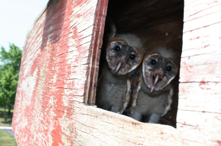
Young barn owls. Photo by MacKenzie Hall.

Conserve Wildlife Foundation staff work with the New Jersey Endangered and Nongame Species Program (ENSP) to manage and populate the state’s official database of rare wildlife, known as Biotics.  Currently, this database contains over 35,000 animal and plant records within New Jersey.  ENSP and CWF currently collect and enter data for the state’s 173 endangered, threatened, and special concern species.

There are several species of birds for which more observation data would be useful; and it’s likely that birdwatchers or other nature watchers may have the data needed.  Most good birdwatchers keep logs of what they’ve observed, when, and where.  It would be helpful if anyone with detailed observation data for the species listed at the end of this blog could submit their data for potential inclusion in the Biotics database.

To submit your observation data, please complete a Rare Wildlife Sighting Report Form.  The form is available on ENSP’s website for download as well as instructions for completing the form (a map must be attached when submitted).  In addition to the species listed below, please feel free to submit one or more forms for any of the state’s endangered, threatened, or special concern species.  A complete list of all of the species tracked by the state can be downloaded here.

If you have a large amount of data to submit, please contact Mike Davenport of Conserve Wildlife Foundation at (609) 292-3795 – alternative data submission options may be available (such as submitting Excel spreadsheets or GIS files).

Barn Owl (Tyto alba)
Nashville Warbler (Oreothlypis ruficapilla)
Saltmarsh Sparrow (Ammodramus caudacutus)
Sharp-shinned Hawk (Accipiter striatus)
Spotted Sandpiper (Actitis macularius)
Whimbrel (Numenius phaeopus)
Winter Wren (Troglodytes hiemalis)

Keeping Wildlife Range Maps Current

RECENT UPDATES TO SPECIES RANGE MAPS

By Michael Davenport, Marine Species & GIS Programs Manager

The former and revised range maps for the Checkered White butterfly in New Jersey.

Just as world maps get updated with the addition of new countries (most recently South Sudan in 2011), wildlife range maps also need to be revised occasionally as new information becomes available.

There are 173 range maps available on Conserve Wildlife Foundation’s on-line field guide web pages for New Jersey’s endangered, threatened, and special concern species.  Although some of these maps were created only two years ago, 23 range maps were in need of minor to major revisions since new data had become available.  The range maps are based upon data within the NJ Department of Environmental Protection’s Biotics database, the official statewide database of rare wildlife.  While some new data was received from biologists’ surveys, a portion of it was received from the general public who submitted Rare Wildlife Sighting Report Forms for their own personal observations.

One of the most striking range map revisions is the Checkered White Butterfly.  Previously documented only at Newark Airport, this species has now also been documented in southern New Jersey.  Whether or not this disjunct population has been there all these years and not reported (flying under the radar so to speak), or this represents a recent natural range expansion or introduction is unknown at this point.

Take a tour of our on-line field guide – revised maps are labeled “2012”.

Observations of Rare Species Wanted!

NATURE WATCHING ISN’T JUST FUN, IT CAN BE USEFUL TOO

By Michael Davenport, Marine Species & GIS Programs Manager

Like many birdwatchers, although I still enjoy seeing the neighborhood cardinal in my yard, it’s the sightings of rarely encountered species, especially those classified as endangered, threatened, or special concern, which really keep my eyes scanning around during a hike.

Observations of Special Concern species, such as this Eastern Box Turtle, may be reported to the NJ Endangered Species Program. Photo by Mike Davenport.

Many birdwatchers, or nature enthusiasts of other species groups such as reptiles or butterflies, share their encounters with rare species on websites or bulletin boards.  In addition, several organizations, such as the Cornell Lab of Ornithology or NJ Audubon, recruit “citizen scientists” who collect species observation data and submit that data electronically via websites such as eBird.  That data is important for those organizations’ scientific research and assists scientists in analyzing population trends over years.  However, more often than not, it never finds its way to New Jersey’s state biologists nor the state regulators whose task it is to protect rare species habitat in the state.

The New Jersey Endangered and Nongame Species Program (ENSP) collects data for, not just rare birds, but all of the state’s endangered, threatened, and special concern species.  A Rare Wildlife Sighting Report Form is available on ENSP’s website for download as well as instructions for completing the form.  A complete list of all of the species tracked by the state can be downloaded here.

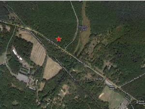
A map of the location of your observation, such as this one, should be sent with your Rare Wildlife Sighting Report Form.

Rare species data within the state’s database plays a critical role in wildlife and habitat conservation. It is the foundation of the NJ DEP’s Landscape Project, a GIS product that maps critical areas for imperiled species based upon species locations and land-use classifications. The resulting maps allow state, county, municipal, and private agencies to identify important wildlife habitats and protect them in a variety of ways. This information is used to regulate land-use within the state and assists in preserving endangered and threatened species habitat remaining in New Jersey.

Reporting your rare wildlife observation is easy.  Simply complete the form, attach a map of where the animal was observed, as well as any photographs taken, and then mail or e-mail the form and map to ENSP at the address provided on the form.  For more details about the state’s rare species mapping, please visit our webpage.

Updated Version of the Landscape Project (NJ’s Rare Wildlife Mapping Tool) Released

A CRITICAL CONSERVATION TOOL JUST GOT BETTER

By Michael Davenport, Marine Species & GIS Programs Manager

To coincide with the NJ Department of Environmental Protection’s (DEP’s) adoption this week of revised lists of endangered, threatened, and special concern species in the state, the DEP’s Endangered and Nongame Species Program released an updated version of the Landscape Project earlier this week.

The Landscape Project is a mapping tool, created using Geographic Information Systems (GIS), which displays wildlife habitat throughout the state ranked according to the rarity of the species which occur in specific patches of habitat.  The highest rank (5) is used to indicate habitat for those species which are federally endangered or threatened.  Rank 4 is used for state endangered species, rank 3 for state threatened species, rank 2 for species of special concern, and rank 1 is for suitable habitat patches for which no rare species documentation currently exists.

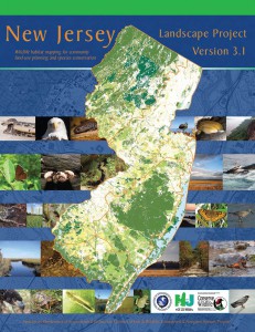
The Landscape Project Version 3.1 report.

The updated version of the Landscape Project is known as Version 3.1 (V3.1) and it replaces both Version 3.0, which covered the Highlands region only, and Version 2.1, which was applied to the remainder of the state.  Both previous versions were released in 2008.

Several changes have been in the methodology and source data used to create this latest version of the Landscape Project.  First, V3.1 is based upon 2007 Landuse/Landcover data, as opposed to the 2002 data used in previous versions.  Second, over 3,500 new rare species records were used in V3.1 and the newly adopted endangered, threatened, and special concern status changes are reflected.  Also, species not included in previous versions, such as whales, sea turtles, and freshwater mussels, are included.  More detailed information is also available in V3.1 such as the type of occurrence documented (nest, foraging habitat, etc.) and the last year that the occurrence was documented.

Since creation of the first version of the Landscape Project in the mid-1990’s, it has been a valuable tool for conservationists, land managers, state and local governments, as well as others.  Municipalities often refer to it in creation of their Environmental Resource Inventories (ERIs) and land trusts often use it to target areas for open space acquisition.

Continue reading “Updated Version of the Landscape Project (NJ’s Rare Wildlife Mapping Tool) Released”

Creating Range Maps for NJ Wildlife

USING CARTOGRAPHY TO ILLUSTRATE WHERE SPECIES LIVE

By Michael Davenport, Marine Species & GIS Programs Manager

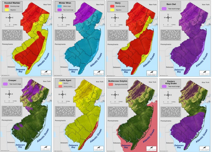
Several range maps found on the CWF on-line field guide.

Conserve Wildlife Foundation of NJ (CWF) staff have been busy updating the CWF website’s on-line field guide with additional species’ profiles in order to add descriptions for New Jersey’s Species of Special Concern.  One important component of the on-line field guide, like almost any other field guide, is the inclusion of a range map.

Our Online Field Guide

The CWF on-line field guide is specific to New Jersey, so the only portion of each species’ range illustrated is that portion within the boundary of the state.  For a species’ full range, there are numerous additional sources of information.  CWF, being focused on New Jersey wildlife, is uniquely able to provide more specific range information based upon the data available to our staff as well as our first-hand knowledge.

The range maps within the on-line field guide are created using Geographic Information Systems (GIS) software and multiple sources of data.  First, we begin with the raw species observation data which is maintained within the NJ Endangered and Nongame Species Program’s (ENSP) Biotics database, a database which CWF staff maintains in partnership with ENSP.  Then, like any range map, some generalization needs to be made to account for the fact that animals cannot be observed 24 hours a day, 365 days a year.  In order to do so, data such as land cover types, hydrology, and/or topology is considered in order to fill-in the areas between observation points or omit other areas. Continue reading “Creating Range Maps for NJ Wildlife”