Shorebird Expedition Brazil: The rights of traditional communities

By Larry Niles, LJ Niles Associates LLC

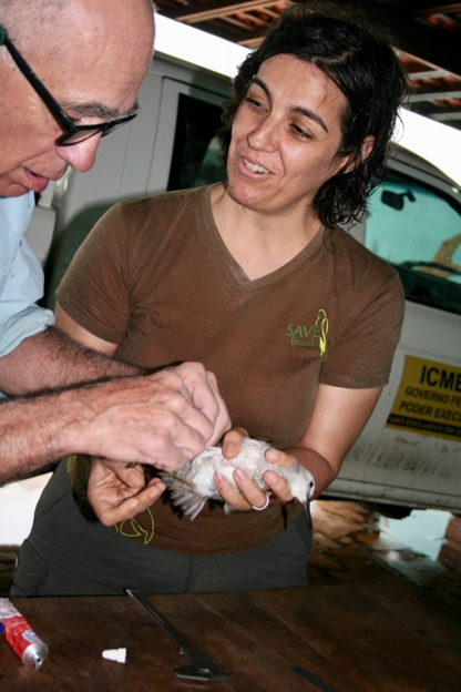
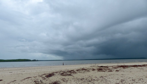
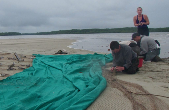
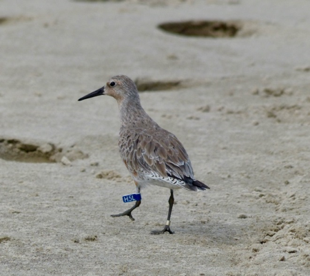
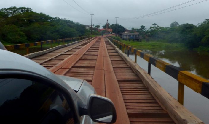
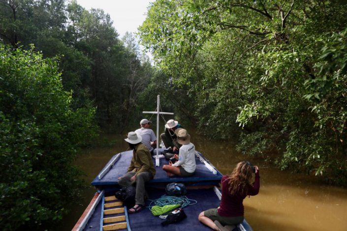
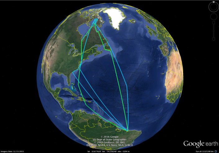
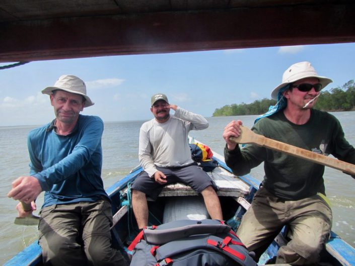
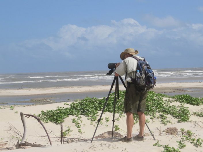
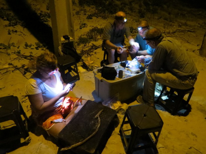
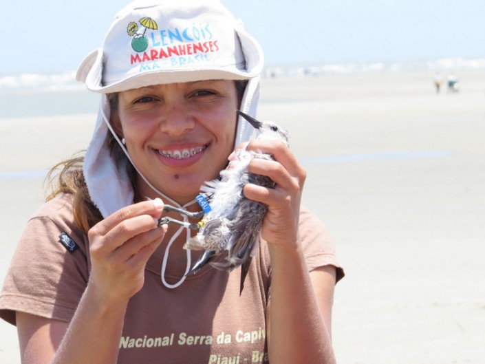
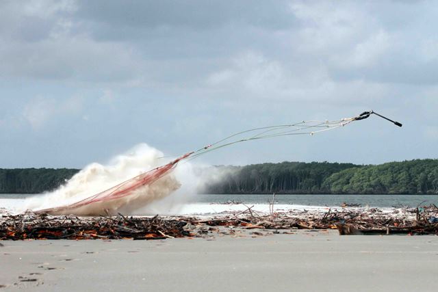
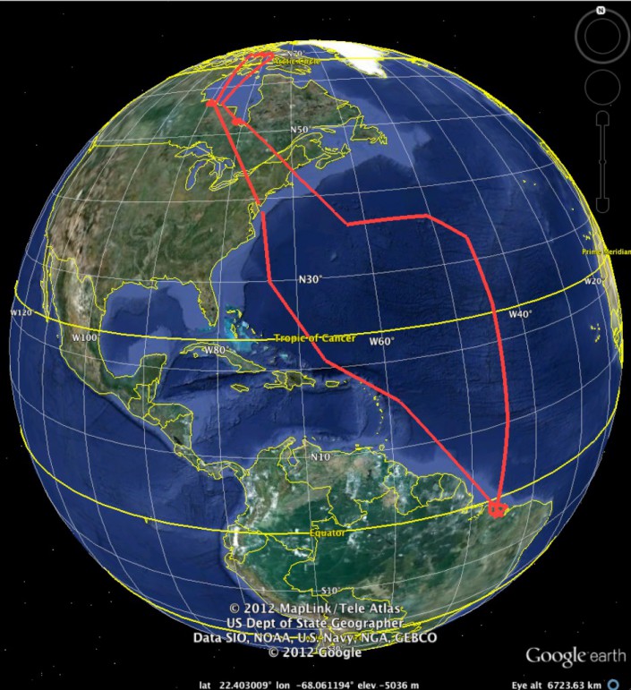
Over the last few days of our expedition, we left the state of Para and flew to Sao Luis in the adjacent state of Maranhao. There we began the next phase of our work, trapping red knots, ruddy turnstones and other species, as we have done since 2014.


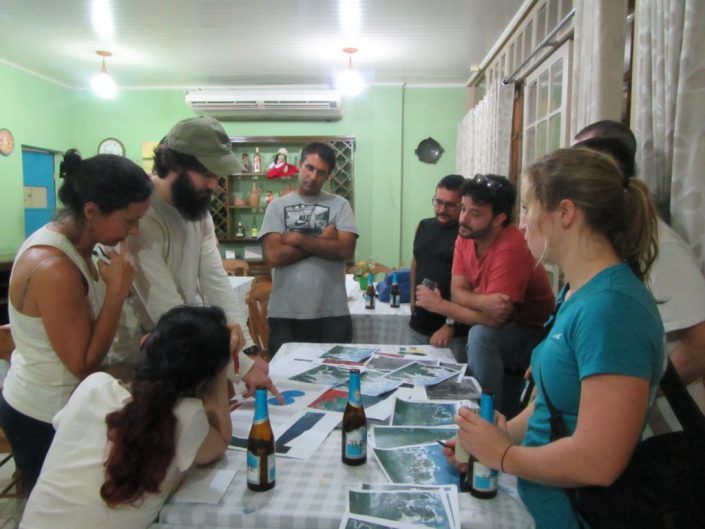
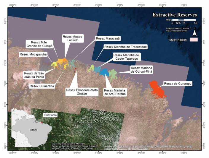
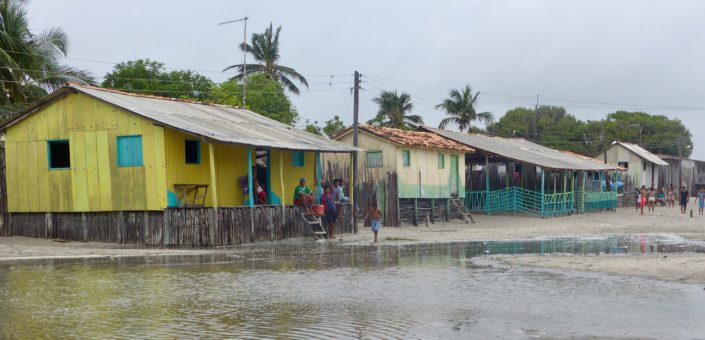
But prior to leaving Para, while we stayed in the village of Apiu Salvatore, the fishermen asked to meet with Max. He hadn’t planned it, so at first, the reason was unknown. The fishermen of the village knew Max represented ICMBio, and that Apiu Salvatore fell within Resex Gurupi-Piria, one of the Brazilian agency’s many extractive or Resex reserves. As I described in the previous post, ICMBio conserves natural resources in each reserve for the benefit of traditional communities, such as this one. So Max had a good idea what the community had on their mind.


David and Danielle prepare for the meeting with the fishermen of Apiu Salvadori.


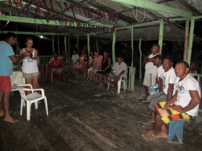
We entered the large open meeting space under a thatch roof with a good breeze cooled by a sudden evening downpour. The association leader, Antonio, got down to business. He explained the problem of immense ships lurking offshore, spreading giant purse seines or immense lines of baited hooks, and stealing all the fish. It threatened their own lives, not only their livelihoods but their very existence. One could see very clearly how vital fish were to these fishermen. The community consumed virtually no goods; most of their daily needs came from the sea or their backyards. Chickens, pigs, even lambs filled backyards.  Fruit like mangos and avocados literally fell from the trees. I saw no washing machines, microwaves, coffeemakers, or nearly any of the appliances that litter a typical U.S. kitchen.


There was one modern device found in every hut and cabin, no matter how small or dilapidated. All had TVs.  How, I imagine, can they fit in this primitive world while gapping at the lives of the rich and famous? These were not people ignorant of the world, but unfortunately, they could be innocent as lambs when faced with the greedy schemers and politicians of Brazil. And as the ongoing corruption scandals here evolve, it seems like nearly every politician serves their own or other greedy interests.


So it is understandable that the fishermen’s first thought was to go to the Catholic Church. But then we came. So they asked for Max’s advice.


The people of the village live simply with no luxuries except TVs. The town, located on a small island has no electricity except when the community generator is turned on at night. (Photo by C. Buiden.)

He quickly determined the fisherman had no idea they had legal rights to the fishery. He patiently explained the concept of ICMBio reserve system, the system of which they are a part. In theory, they could unify and certify their observations, take it to a judge and get a decision that would force the government to stop the theft by the international fishing fleet, at least in principle. Max and Danielle explained these rights and the group seemed sufficiently inspired. At least they left happy.


Why did they not know their rights? Max explained to me that the reserve manager for this area covered 60 other villages and that ICMBio has suffered 3 years of budget cuts. He reminded me how long it took to get to this village. So it’s the usual story familiar to U.S. agency biologists.  Here, as it is in rural U.S., but with a more obvious impact, starving good government often only starves the people who live on the land, the land itself and the wildlife, who depend upon it.


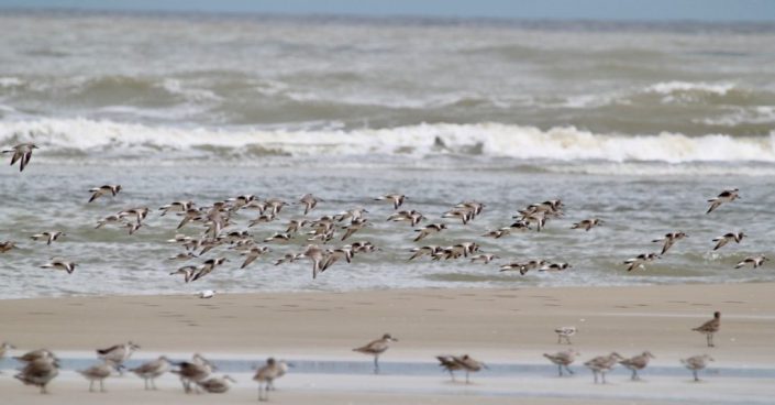
For me, it meant something more. We proposed this project to create better protection for shorebirds. We took the usual approach. First, do the surveys then will create scientifically defensible descriptions of the habitat’s value.  Finally, we overlay the threats: shrimp farming, oil spills, human disturbance, predators etc. then develop counter-measures.


I learned that nigh there is only one threat in this, one of the most important shorebird habitats in the world. It looms large above all others – if you erode ICMBio’s system of protection all the other threats will grow and decimate the fragile ecology of the area. Grow the ICMbio system and the traditional communities will enforce their legal right to conserve. They can monitor the threats and work with the agency to stop them. The laws already exist. The monitoring system is already in place. But this meeting pointed out they need more help.


Photos by C. Buiden.


Dr. Larry Niles has led efforts to protect red knots and horseshoe crabs for over 30 years.


Shorebird Expedition Brazil: Trapping shorebirds in Panaquatira

By Larry Niles, LJ Niles Associates LLC

The capture of Arctic nesting shorebirds first brought us to Brazil in 2013.  We brought 125 geolocators and caught both ruddy turnstones and red knots, attaching 85 on the former and 30 on the latter.  But we also came to create a new perspective on shorebirds in this place, one of the most important shorebird habitats in the world.


For all intents and purposes, shorebird work in this area started in the mid 1980’s, when Canadian biologists, Guy Morrison and Ken Ross surveyed from an airplane, the entire coast of South America.  In this monumental and dangerous survey they established an invaluable historic baseline of the number of Arctic nesting shorebirds wintering in South America. This was before shorebirds caught the interest of the public, and way before foundations and agencies devoted significant funding or staff time.  They surveyed the entire continent, but on the coast of Maranhao and Para they found the motherlode of shorebirds.  They did not, however, get close and personal.

Guy Morrison and Ken Ross about to conduct an aerial survey (also in the photo is Guy’s daughter Clair, Brad Winn, Jorge Jordan and Luis Venegas).

That challenge belonged to a team led by the late Allan Baker of the Royal Ontario Museum and Ines Serrano, then with CEMAVE, the Brazilian counterpart of USGS.  They also flew the coast but followed up with a ground survey and the capture of a small group of red knots. Along with Guy and Ken, their work cemented the hemispheric importance of this area.

Juliana holds one of the two birds caught in our second day of trapping. (Photo by C. Buiden)

Over the last 4 years we captured knots, turnstones, sanderlings, whimbrels, collared plovers, semi-palmated sandpipers, semi-palmated plovers as well as South American terns and other species. Last year we recaptured 20 geolocators in a catch of over a hundred ruddy turnstones.  But only in 2013 were we able to catch red knots. Although abundant in the region, populations are estimated at 10 to 15K, they are remote and elusive.


So we were happy to find on our first day of surveillance this year over 400 red knots. They roosted within a flock of about 1000 shorebirds located at the west end of a small working class beach resort called Panaquatira, about an hour out of Sao Luis. The flock including black bellied plovers, semi-palmated sandpipers and plovers, collared plovers, South American terns, Black Skimmers and a few whimbrels. We readied that night for an early morning attempt.


First we needed to figure out the tide. It rises and falls 13 feet in northern Brazil, twice that in Delaware Bay. The spring tide or full and new moon tide increases the range to 18 feet.  Consequently, the high tide line moves every day and catching birds with a cannon net depends on placing the net near the predicted tide line, because birds move with it to stay as far from the dangers lurking on dry land. Wind speed and direction changes the high tide line, and so does barometric pressure.


So much rides on where we place the net. On our first two attempts, we missed by just a few yards, but it could have been a mile. The birds moved with the tide and stood just outside the 30 by 100-foot area within which the birds must be to be caught. We tried moving them but they spooked and most gradually left the area altogether. Ultimately, we fired but caught only two knots and two whimbrels.


We were blessed on the third day. We arrived near dawn, over four hours before high tide so we had plenty of time to measure elevations. We knew the morning’s high would be about four inches lower than the previous night’s high, which snaked along the sandy peninsula used by the birds to roost. Standing on the tide line we used a method borrowed from Clive Minton to determine the location on the beach four inches lower.


Laying my head flat on the sand I trained my eye towards the horizon. This establishes a level line. Using her hand, Stephanie marks four inches on her leg than moves until the four inch mark lines up with the level line. Her location depends on the slope of the beach. In this way we determined the location of the tide line four hours hence. We dug in the net.

Larry Niles and Mandy Dey take training on measuring elevation from Clive Minton in Australia.

At about an hour before high tide, shorebirds started crowding into the area around the net. At first, oystercatchers, black bellies, short-billed dowitchers and a small flock of skimmers. Most of the knots hung back on an adjacent sand bar. With a little push, they too piled in right into the catch area.


We fired and caught 175 knots, 30 sanderlings, 20 short-billed dowitchers and 5 black-bellied plovers. Among the knots were 3 with geolocators. We flagged, banded and measured 145 birds, all the while releasing unprocessed birds that appeared stressed by the heat. By late afternoon we were back at the house cracking open beers. We completed all our objectives with one day to spare.

CWF Biologist Stephanie Feigin moves birds closer to the net. (Photo by Yann Rochepault.)


Stephanie and Julianna begin taking birds out of the cannon net. (Photo by Yann Rochepault)


We must cover birds with a light shade cloth to calm birds while they are extracted and placed into keeping cages. (Photo by Yann Rochepault.)


Processing our catch. (Photo by Yann Rochepault.)


One of the many values of catching shorebirds is examining their condition and molt. Here we compare two knots, an adult on the right and a second year or sub adult on the left. The latter molts its flight feathers much earlier than adults and it shows in the fading to brown. (Photo by C. Buiden).


Our team includes Carla Meneguin, Paulo Siqueira, Ana Paula Sousa, Larry Niles, Juliana Almeida, Carmem Fedrizzi Joe Smith, Stephanie Feigin, Yann Rochepault, Laura Reis and Christophe Buiden. (Photo by Juliana Almeida).


A red knot after banding and processing. (Photo by Y. Rochepault).


Dr. Larry Niles has led efforts to protect red knots and horseshoe crabs for over 30 years.


Shorebird Expedition Brazil: Going to the heart of the mangroves

Hundreds of red knots found to cap long day’s journey

By Larry Niles, LJ Niles Associates LLC

It took us long into the night to reach our next port.  We went from the relatively populated area of Braganza to the dark heart of this coastal region of Viseu. In three trucks, we caravanned through a maze of remnant tropical rainforests, cattle pastures, and impenetrable second-growth woodlands. Along the rain-slicked, red clay road, small and desperate looking towns popped out of nowhere always looking like the past was a better day. The road cut through countless mangrove forests that define this region.  We reached Viseu too late to do anything but find a place to stay the night.

A bridge across the many rivers from Braganca to Visiu, Brazil. Photo by Christophe Buiden.

By noon the next day, we boarded a Lancha boat named Garota Viseu (Viseu Girl). Local shipwrights craft these two-decker boats of about 50 feet in length, primarily to carry cargo and people from port to port.  Today it will carry us into one of the most remote estuaries in the 250-mile coastline of this enormous mangrove and beach landscape.  Our captain, 78-year-old Benedicto, with one crew navigated the coffee- colored Gurupi, a long river that cuts deep into the tropical coastline.

A nearly completed boat in a ship yard in Viseu.

Bene took his craft down the Gurupi within sight of the wind-tossed Atlantic Ocean.  The trade winds blow constantly here, almost always at near gale levels.  But then he turned into a small channel directly into the steamy mangrove forest.  At first the path was wide, lined with a dense tangle of mangrove on either side.  Whimbrels, scarlet ibis, semi-palmated sandpipers clung to tangles of roots as the high tide flooded the soft mud.

Captain Benedicto piloting his Lacho boat, the Garota Viseu.

Then he took the boat in a channel so narrow, the crew had to duck the whipsaw of mangrove branches.  We slowly snaked our way through a tunnel of green until we reached another wide channel.  Within a few minutes, we entered another narrow channel ultimately reaching the next bay.  Here we felt the full force of the stiff winds and deep rolling swell of the Atlantic.  An hour later we weighed anchor at the small community of Apiu Salvadore.

The Garota Viseu weaves its way through the narrow mangrove passage. Stephanie Feigin, Danille Paluto, Christophe Buiden and Yann Rochepault watch from the top deck of the boat.


Few people from the outside world come to this community of about 50 ramshackle huts and cabins and about 150 people. As the boat neared the shore with most of the team standing on the roof of the boat, scattered groups of the town’s people stood on the sandy bluffs overlooking the harbor as though we just landed from space.  Ultimately, we found them welcoming but wary.  Little good comes from the outside to these communities.


Over the next two days, we plied our craft of field biology. We needed to find small boats to take teams to the various shorebird habitats previously determined on our maps. Local craftsmen build these boats. Running about 20 feet in length, they use 10 to 20 horse power engines meant for something like a lawn tractor. Instead of driving a blade, the craftsmen power a long shaft that ends in a 8-inch propeller. The skipper can lift the engine and propeller according to the water’s depth. They suited our needs perfectly.


We fielded five teams in three in boats while Mandy, David Santos, Carmem and I surveyed Lombo Branco Island, about two miles from the Apiu Salvador. The sea shapes this island into a crescent, the inside protected from the restless waves.  Nestled within, one could see in miniature, the whole ecological system that creates resources for shorebirds.


At the heart of the island grows a small and stunted mangrove forest and an apicum, or wetland that only floods during lunar tides or spring tides. These are the highest of the monthly cycle of tides but only occur on the full and new moon. Every day the tide moves in and out of this small system. Twice a month the tide floods the apicum for several days at a time.

We arrived on the day of a waxing moon, near full. The very high-high tides reached well within the small drainage flooding habitats that have not been flooded in a few weeks. Shorebirds carpeted the wet mud, searching for all the invertebrate life that flourishes in this habitat. But the productivity only starts there. Here the tidal flow is gentle because the island shields it from the wind tossed Atlantic from all sides except the leeward quarter of the island. This gentle tidal flow flushes sediments from the mangrove swamp, the nutrients of the apicum and the normal productivity of a sediment-rich sandy substrate, forming the base layer of a productive food chain that nurtures small clams and other invertebrate – all prey for shorebirds.


We found whimbrels, semi-palmated sandpipers, ruddy turnstones, short-billed dowitchers, black belly plovers, willets, semi-palmated plovers, sanderlings and collared plovers.  In the lower reaches, we found 337 knots, a glorious find that will help our mapping model enormously.

Red knots, sanderlings, short billed dowitchers and other shorebird forage in the inter-tidal estuary of Morro Branco.

The following day we surveyed a second island, Coroa Criminosa. Why the sinister name we cannot say, but it supported a very similar esturary giving us another successful day. When the tide went out the small island of about 6 kilometers grew to over 20 kilometers. Intertidal sand flats spread out of sight in nearly all directions.


We left the island that night and arrived in Viseu just before dark. Once again we suffered the sway of the Atlantic. After weaving our way back through the mangrove and up the Gurupi River, we landed too late to go on.  We were thankful for the modest rooms with showers, a good meal and beer!


https://youtu.be/zLW4iRr_EI4


Dr. Larry Niles has led efforts to protect red knots and horseshoe crabs for over 30 years.


Shorebird Expedition Brazil: Conducting a scientific investigation in a tropical wilderness

By Larry Niles, LJ Niles Associates LLC

It’s hard to imagine the difficulties of people living here at Latitude 37 Degrees North when arriving at the equator in northern Brazil. It challenges even the hardiest of biologists. However, after three days our team has not only acclimated but we accomplished surveys in two separate estuaries.


Ruddy turnstone multiyear flight recorded by a geolocator caught in Maranhoa, Brazil.


Low tide was cut short on our first day in the field, while high tide persisted longer than we expected which challenged our surveying since it must take place when birds forage. Shorebirds typically forage until 1 to 2 hours before high tide and start again 1 to 2 hours after high tide, usually resting and digesting the food consumed at the lower tides. Because we intend to understand the foraging habitats of shorebirds in the wintering area, we must focus on the lower tides. This is always difficult due to logistical issues such as renting boats, equipment failures, and long distance from the ports present an array of complications. Still, we were able to go out in the field and collect some data.


The next day we did marginally better, each team member faced different problems. Our boat engine failed and we had to paddle back to port, another boat took so long to get to the shoal we intended to survey that it had already been covered by the tide.  But this is the nature of field work anywhere.


Yann and Christophe paddle our boat back to port after the engine failed.


No matter the complication, it is important to stick to our rigid protocols.  Our goal is to determine the best places for shorebirds in this area. We must work with the shorebird’s behavior because each tidal stage creates different value.  In a wild place such as this, they will choose to roost as close to the foraging areas as possible. In fact most will just roost then feed as the tide recedes then feed as the tide rises and then roost again.  So locating the feeding areas will usually indicate the roosting areas.


But things can go awry. In human dominate habitats like New Jersey, birds find it hard to roost near foraging areas. Most often the high tide forces them into people jogging, dog walking or enjoying flushing shorebirds.  So the shorebirds must leave, unnecessarily burning valuable fuel and suffering greater danger from avian predators.


The night-time roost creates the real threat here in Brazil and everywhere. At night many dangers lurk.  Ground predators, such as owls, feral cats, raccoons, and even people will take advantage of any unwary or sickened bird.  It is worse when birds are forced to use areas that are less secure than others. This can happen naturally at spring tides, for example, when the very highest high tides force them closer to the dangers lurking in the dunes or mangrove forests.  In places like Hereford, New Jersey, people often force birds to use more dangerous areas.


Larry Niles surveying.


So our goal here is to map all the areas of importance – foraging, day-time roosts and night-time roosts.  But we hope to do it with remote sensing; satellite maps that are trained by a mathematical model, that are, in turn, trained by our field data.  We count birds, photograph the surrounding habitats, precisely locate the sites, and even look at the substrate.  Is it mud, sand, muddy sand, sandy mud and so on?


Doing this in New Jersey is difficult.  Doing it in the northern coast of Brazil presents untold challenges.  One cannot easily access the coast here.  We have to rent boats to take us out to the birds, conduct surveys then get back before dark.  Sometimes we go out for days and stay in remote fishing villages, sometimes with only a floor to sleep and no facilities or power. Imagine unrelenting heat, mosquitoes, persistent blowing sand, copious sweat, and trying to conduct a scientific investigation. That would be demanding in any environment.


So this is the challenge of our crew – and they do it aplomb!  Last year one of the boats sank in 55 feet of water 8 miles out to sea. We all made it to land safely but we lost much of our equipment. The day after was grim, wondering if we should we go on or go home?  Without hesitation, not only did the crew go on to complete the survey but we ended up capturing twenty-two geolocators from ruddy turnstones tagged two years earlier. A good crew is hard to put together and stay productive in these conditions. A good spirit is the most important thing.


Our team chooses areas for the next day’s surveys. Beer is essential!


So we completed two days of surveys at the western end of our 150 miles long study area. Today we prepare for three days out to a remote area, accessible by boat only.  As I write, the team prepares for food, water and all the necessities of spending three days with minimum comfort.  We hope to camp in a fishing village, maybe a house, but we won’t know until we get there. We must prepare for all possibilities.


Our understanding of the inner workings of the Brazilian Extractavista reserve system grows every day. This system I believe holds great hope for us in the United States because it serves both the wildlife and fish and the people living in the landscape.  Pretend, for example, on Delaware Bay, the rural towns and the residents get first crack at the sustainable management of resources, not the companies exploiting them without regard to the future, as it is now. Instead of few people earning a good living off Delaware Bay resources, many would. Rural American would be transformed. This is what ICMBio hopes to achieve in this much poorer area.


Two members of our team are managers of the seven reserves in Para, our study site. They told us, for example, ICMBio (Chico Mendes institute), the federal agency in charge of the extractive reserves, pays a subsidy for local fishermen in exchange for helping manage the fishery resources. But the subsidy is limited to existing residents, not people within new reserves because of the new conservative government. One can see right away the challenges of two people managing seven reserves covering a coastline the size of New Jersey. Budget cuts have taken away all equipment funds. They must even clean their own offices as most nonessential staff has been cut under the new conservative government, a government accused of unfairly deposing the most popular liberal party.


This should resonate in the United States because it could be coming soon to a wildlife reserve near you.


Wintering knots in roost.

Dr. Larry Niles has led efforts to protect red knots and horseshoe crabs for over 30 years.


Shorebird Expedition Brazil: Investigating the plight of shorebirds and rural people

By Larry Niles, LJ Niles Associates LLC

We leave a cold and dark New Jersey with mixed feelings for our destination to tropical Brazil. It will be warm and sunnyish – though forecasts predict drenching thunderstorms threatening us every day of our trip. We will explore a very new place, the ocean coast of Para, a largely unsurveyed coast known to be a wintering shorebird mecca. At the same time, we will undergo trials experienced by few biologists. Zika is prevalent in Para, but recent cases of malaria are equally alarming.  Of course, one must be ever vigilant for food and water pathogens. Last year, I developed food poisoning ending me up in a rural hospital, with a room full of very sick people. On arrival, I wondered what comes next?


A small part of the sprawling city of Sao Jose de Ribamar.


The contrast of poverty and the truly wild can jar a Jersey biologist’s sensibility.  People fall into poverty here because it’s the common condition.  Poor sanitation, terrible roads, and nearly non-existing law enforcement plague those who live in coastal Brazil.  The economic crisis and the ever-expanding corruption scandal in the federal government rob people of hope for the future and anchor them to a life of poor education and wages, and widespread filth.  In the cities, the water churns with rubbish and contamination is ubiquitous.


Yet few people populate the ocean coast sites where we will survey.  There, the sea teams with fish and shellfish beyond measure.  Walking through a fish market is like going to a fish museum for all the species, exotic and common.  Hundreds of small villages, most with only occasional power, perch precariously on the edge of this wonderful and largely uncontaminated sea or nestle deep in a vast mangrove forest, one of the largest in the world.  In many ways it’s a biologist’s wonderland.


Our team walks through a small fishing village in the Brazilian state of Maranhao. The village has no power system just a generator that turns on in the evening for a few hours.


Only a few hundred miles away snakes the many channels of the Amazon River and surrounding it lies one of the world’s last great tropical forests.  It’s the home of one of the great battlegrounds of environmentalism.  The new U.S. administration will probably support the wealthy families cutting away valuable timber for cattle ranching, destroying carbon capturing and oxygen producing trees and, at the same time, the livelihood of native people who eke out a bare existence from rubber, nuts and the diverse wildlife that share the forest with them.


An illegal forest cut in the Brazilian rainforest in the state of Para.


But our government has a lot to learn from the Brazilians. They have created a novel conservation system, one unknown to us in the U.S.


They call them extractive reserves. The federal agency in charge, ICMBio, struggles to save these reserves, not for tourists or rich residents, as we do in New Jersey, but for the people who live within.  They stop the ranchers from destroying the forest. In the same way, they stop the international fishing fleets from decimating the fishery in Para. Staff of the agency die every year doing their job. One just recently in the state of Para, not far from our destination.


There are seven extractive reserves in our coastal study site in Para, Brazil. This map was created by Dan Merchant and Rick Lathrop CRSSA.


Our project aims to help. Our team, sponsored by Conserve Wildlife Foundation with Neotropical Migratory Bird Conservation Act, will survey birds, measure habitat, and ultimately map this coast with state-of-the-art GIS system developed by Rutgers Center for Remote Sensing and Spatial Analysis.  We intend to provide ICMBio staff with better GIS tools than are available in the U.S.


Over the next three weeks, we will be reporting on our research investigation. We will also explore the threats to the extractive reserves in our study area, everything from disturbance to shrimp farms.


For my part, however, I will also investigate if this system captures the best conservation envisaged by most religious leaders, including Pope Francis. Despite the political rhetoric of the old politicians that fill our media, most of the world’s religions speak openly about supporting climate change action. They envisage an “integral ecology”, in the word of Pope Francis, a union of the need to heal the earth and the plight of the poor.  Even Southern Baptist have adopted this position that the impact of climate change falls on the poor.  This is as true in Brazil as it is in Delaware Bay.  Perhaps in Brazil lies a better way.


Dr. Larry Niles has led efforts to protect red knots and horseshoe crabs for over 30 years.


Science in the Mangroves

Update from Brazil: “We are Going to Have to Science the ‘Heck’ Out of This”

by Dr. Larry Niles, LJ Niles Associates LLC

larger view of brazil


We came to Brazil to conduct a rigorous scientific study of the wintering population of shorebirds in a place where the land and sea act against any rigorous protocol. It would be easier to just go out and count birds and identify their habitats and prey, but our charge is more difficult.


The survey wraps around satellite imagery, strange unintelligible wavelength data coming from satellites hovering over the earth that can be transformed into brilliant and useful maps in the right hands. Those hands belong to Professor Rick Lathrop and his post doc Dan Merchant. Rick leads the Center for Remote Sensing at Rutgers and he and I have collaborated on projects ranging from municipal habitat conservation planning to Arctic red knot habitat mapping. He has created one of the most alarming maps that every person from New Jersey should know about.

nj_landchange450

The mapping of Reentrancias Maranhenses, an internationally recognized site of ecological importance is especially tricky. Our research platform is a 50-foot boat and we will be out of cell and internet contact for much of the time. Our method of collecting data for the mapping was devised by the whole team, but especially with the help Professor David Santos of the University of Maranhao, my colleague Dr. Joe Smith and Humphrey Sitters of the International Wader Study Group.

Our 50-foot catamaran

It focuses on collecting bird and habitat information using randomly selected survey points. In other words, we will try to pick places at random to survey so that when we combine them we will have a sample that represents the entire area, not just the places we surveyed. It’s like trying to figure how many different kinds of chocolates are in a valentine. If you take them all from one side then you might have sampled the chocolate covered cherry section leading to believe they are all one kind. But if you choose chocolates at random than you will find the box includes other kinds,  caramel or fruit or nutty chocolates. This is making me hungry, but you get the point.


The area  of our box we is very large, bigger than New Jersey, and it grows and shrinks every day with the tides. So, sampling is tricky business because a sample at low tide, when the tide is out exposing vast areas of intertidal mud and sand flat, is very different than when the tide is high. So we will be classifying habitat, or stratifying it, so we  can focus on limited survey time to get the best sample.


Once collected we can start making maps.  All data will be geo referenced – or located precisely  with GPS units – so it can be accurately mapped. With this, we will train the satellite maps to outline the habitat best for shorebirds.


All this while exploring areas that have received little scientific scrutiny and under tropical conditions, almost daily rain, a persistent 20 mph wind and summer heat.  Add parasites, mosquitoes and diseases like malaria and one can see this a rugged undertaking.


Our crew is up to it.  Besides those mentioned above Mark Peck from Royal Ontario Museum, Danielle Paluto from the Brazilian CEMAVE (a counterpart to our USFWS), Steve Gates a veteran of expedition on other SA trips, shorebird expert Dr. Mandy Dey, Stephanie Feigin from Conserve Wildlife Foundation of New Jersey and the author round out a dream team of bird study in difficult places.

Our crew banding shorebirds in Brazil in 2014.


Learn more:


Dr. Larry Niles has led efforts to protect red knots and horseshoe crabs for over 30 years.


CWF Biologists Travel to Brazil to Study Red Knots

On our Expedition to Study Shorebirds along the Northern Coast of Brazil

By: Dr. Larry Niles, LJ Niles Associates LLC

Ana Paula with Red Knot

The largest mangrove forest in the world covers the Brazilian coastline at the equator near the mouth of the Amazon river. The forest extends out into the Atlantic in long peninsulas tipped by wind swept and mostly inaccessible beaches. The forest, beaches and their long intertidal mud and sandy low tide flats support the largest wintering population of shorebirds in the hemisphere, perhaps the world. The red knot, a listed species in both North and South America, also uses this remote tropical coast.

Boat Trip Route
Boat Trip Route
Catamaran
Catamaran


With scientists from the U.S., Canada, England and Brazil, we will attempt a large scale mapping of this important habitat using state-of-the-art satellite mapping. We will do this from a 50-foot catamaran and two zodiacs hopping from one mangrove estuary to another and conducting bird surveys targeting key areas over a 150 mile-section of the coast. We will be the first to survey some areas. Our goal is to figure out the main threats to both bird and habitat.


To understand the importance of this area one has to think about it like a shorebird. Although born in the Arctic they actually spend only a few months there. They spend a few months moving from their nesting area to their wintering area. They spend the rest of their lives, the majority of their year in the wintering area. A threat to the wintering area would be grave.


Most of our survey zone is part of the Reentrancias Maranhenses, a protected area of the state of Maranhao, Brazil. Our catamaran captained by William Thomas will leave from a small town near the city of Sao Luis, Brazil. From there we will sail along the coastline moving in and out of the mangrove islands to survey shorebirds, habitat and marine invertebrates. We will “geo reference” all data, or take detailed coordinates so the data can be reproduced on satellite mapping.

Satellite Map
Satellite Map


Satellite maps aren’t really maps as most people understand — pictures or drawings of a section of the earth — they are digital files of remotely sensed data, they are only wavelengths of light that must be interpreted to represent actual habitat. We will train the satellite data so that each habitat will be represented by a combination of spectral data — colors in sense.

Environmental disturbance. Photo by Mark Peck.

Once completed, we can relate the habitat maps with information on birds, their prey and equally important, the threats to the birds and prey. For example, shrimp farming is growing in this area. Entrepreneurs are stripping the intertidal zone of mangrove forest, diking the area and then growing shrimp. Once the area accumulates too much waste and chemicals, they abandon the site and move on to damage another mangrove forest. We will determine which areas are of importance to the birds and potential targets for shrimp farmers. But there is more: oil spills, disturbance from tourists, water pollution are among many.


Over the next three weeks, we will be reporting on our work on this blog.

Log of Red Knot DbY7 with geolocator.


Learn more:


Dr. Larry Niles has led efforts to protect red knots and horseshoe crabs for over 30 years.