Update from the Arctic #4: Knot Plateau

CWF’s Larry Niles is in Northern Canada searching for Red Knots and other shorebirds in their Arctic breeding territory. We are following him and posting summaries of his blog entries as he reports from the field.


Arctic Fox are one of the top predators of shorebird eggs. A mottled brown color in the summer, their fur turns snow white every winter.

Our camp here on knot plateau is spartan. We had to jettison many of the luxury items, like the cook tent, so that we would need to make the 25-mile ATV trip into the plateau only once. Even then, the ATVs were overloaded, and we had numerous problems like flat tires and a cracked support for the back rack.
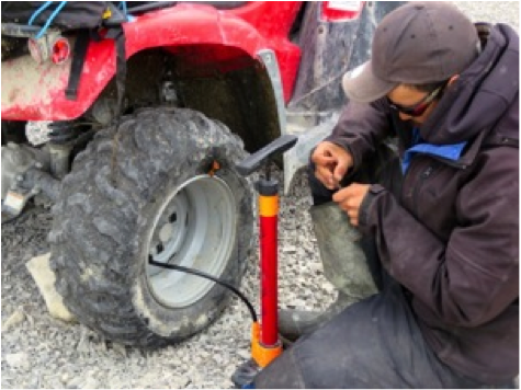
Josh’s skills have proven invaluable, as he has repaired our ATVs multiple times. Here, he fixes a slice in an ATV’s tire from a sharp rock.


At this point in our trip, the rigors of conducting daily field work and sleeping on therm-a-rest mattresses in unheated, low-ceilinged tents are starting to wear us out. Of course, much of this is age-related. The author of this blog, being on the older side of the crew, finds the need to get dressed in a tent the size of a refrigerator box to be the most difficult part of our field experience. Ironically Joshua, the youngest of our crew, has a small campaign tent in which he can stand.


A typical ridge nesting habitat on knot plateau.

But complications such as these are minor compared to what we have discovered: numbers of knots at least equal to the high densities we saw years ago. Better yet, the amount of potential nesting habitat on knot plateau is far greater than other Arctic sites we have surveyed because the knots here are nesting in much greater profusion. This plateau is perfect nesting habitat because these potential nesting sites are surrounded by wetlands where the newly-hatched young can feed, and the complex is also within 10 kilometers of the Sutton River basin. The river remains clear almost year-round, making it a perfect feeding spot for the adults while the nesting area is still frozen.

Team member Mark Peck examines an unhatched American Golden Plover nest.


The greater area of habitat, however, causes great difficulty in finding nests, and it doesn’t help that knot nests are the notoriously hard to locate to begin with. Most shorebirds react to intruders on approach because both adults stay near the nest. But Red Knots, on the other hand, don’t react to intruders because one adult is elsewhere feeding and the incubating bird won’t leave the nest until he is almost stepped on. So far, we have found the nests of several shorebird species such as American Golden Plover, Semipalmated Sandpiper, and Dunlin, as well as those of other birds like Long-tailed Jaegers – but so far no knot nests.
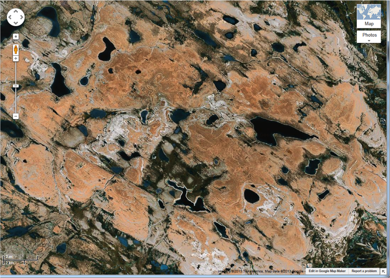
 

A Google Earth image of our study area.
An interpreted map of the same area. Each color represents a different level of desirability for Red Knots.

Our mapping work is going well and may yet prove the most valuable result of this trip. Under Rick’s guidance we are ground truthing interpreted satellite images that already distinguish tundra habitat with good precision. Our task is to train the map to distinguish habitat important to knots. In the end we will create a precise mapping of optimal knot habitat.


All in all, we still have a lot of work to do and not much time left to do it. But even though we have yet to find the knot nests we came for, we cannot help but be pleased by what we have already found.


For the original blog entries, see Larry’s posts Knot Plateau and The Search Continues.

Stay tuned for further updates!


Update from the Arctic #3: Roadless Tundra and River Crossings

CWF’s Larry Niles is in Northern Canada searching for Red Knots and other shorebirds in their Arctic breeding territory. We are following him as he reports from the field. The following is a summary of his latest blog posts.

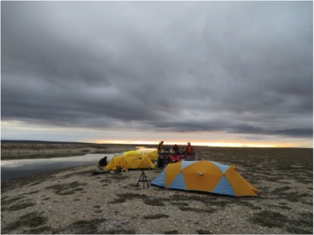
Our camp along the Sutton River.


It has been a grueling, but exhilarating, last few days for our team. At long last, we’ve reached our study site. Anyone else would have looked at this barren plateau and wondered what all the fuss was about, but our team fist-bumped with pride. After three tries, we had finally made it – but getting here was an arduous process we won’t soon forget.


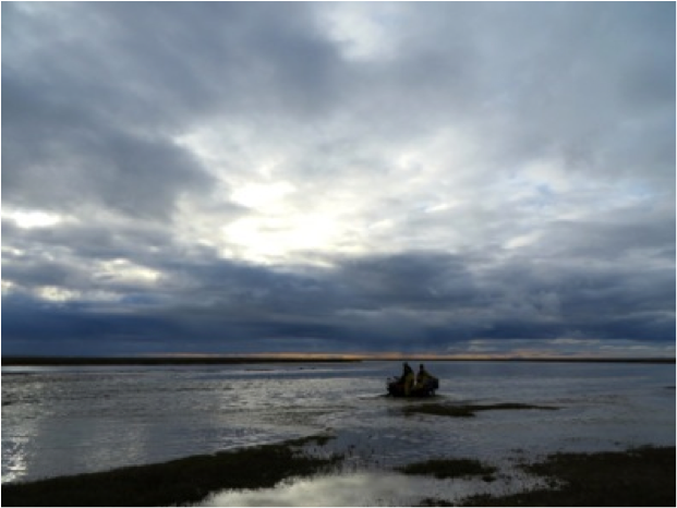
Once into the formidable wetland of the Sutton River, our machines frequently sank up to the axles in mud. We spent most of the day trying to cross the wetland, but couldn’t. And all the while, we had to keep watch for bears.
Once into the formidable wetland of the Sutton River, our machines frequently sank up to the axles in mud. And all the while, we had to keep watch for bears.

We left Coral Harbour on Wednesday afternoon with three ATVs and a truck, as well as a new team member. Josh is our “bear-watcher,” an experienced Inuit hunter whose job is to discourage or, if absolutely necessary, kill an attacking polar bear. We can only hope his services will not be required.


Rick Lathrop uses both topographic maps and satellite imagery to help guide us through this tundra wilderness. Next to Rick, our 3 ATVs are packed with 10 days' worth of supplies for 6 people.
Rick Lathrop uses both topographic maps and satellite imagery to help guide us through this tundra wilderness. Next to Rick, our 3 ATVs are packed with 10 days’ worth of supplies for 6 people.

We had hoped that the road out of town, which was recently extended, might take us all the way to our study site – but it was not to be. Four hours after leaving Coral Harbour, we reached a point where we had to depart from the road and traverse out into the roadless tundra.


We set out by ATV the next morning, but soon ran into trouble. To get to the knot plateau, we had to cross the Sutton River, one of Southampton Island’s major rivers. It’s a gentle stream where it crosses the road, but at the place where we needed to cross it was a wide valley, within which lay one of the most formidable wetlands in the Arctic. The ground shook like Jell-O as we walked, and if an ATV so much as scratched the surface it was down to its axles. After five hours, we had to give up.

Making one of four attempts to cross the Sutton River.


At Josh’s suggestion, the next day we travelled about 15 miles downriver to a crossing used by Inuit hunters. The river was wider there, but we were optimistic because the riverbank was high ground, so we could drive up or downriver over easily-traversed terrain. But after four attempts with the ATV, we could see the river was too deep to cross. The knot plateau was within sight on the other side, but for a second time we had to drive away.


spent
After several days of trying to cross the treacherous Sutton River, we were spent.

Finally, Rick found an almost entirely dry ridge of high ground about three miles to the west of our camp. After crossing the Sutton River near its headwaters, it was five hours of rough riding with fully-loaded ATVs along the ridge to get back to the knot plateau. When the plateau finally rose up before us, we were elated. We drove six more miles before finally setting camp along one of the many lakes in the complex.


Thankfully, water is not an issue. One of the joys in the Arctic is the clear ice melt water almost everywhere. Here, Mark collects water from the Sutton in an Arctic sunset.

The big question we will answer tomorrow is: do knots still use this area? In 1999, there were at least four times as many knots as there were three years ago, following the collapse of the Delaware Bay horseshoe crab population. Knots have disappeared entirely from many areas of the Arctic – are they still here? We shall find out tomorrow.


For the original blog entries, see Larry’s posts: Polar Bears and Roadless Tundra, On to the Land, River Crossings, and Third Time’s a Charm.

Stay tuned for further updates!


Update from the Arctic #2: In Search of Knots

CWF’s Larry Niles is in Northern Canada searching for Red Knots and other shorebirds in their Arctic breeding territory. We are following him and posting summaries of his blog entries as he reports from the field.


A Semipalmated Sandpiper nesting in wetland tundra on Southampton Island.

While flying from Winnipeg to Nunavut, we focused on a strategy for finding red knot nests and adults with broods. We know from our 9 years of Arctic work that knots don’t occur randomly across the tundra landscape. Quite the opposite, they choose very specific places that distinguish knots from other Arctic nesting shorebirds.


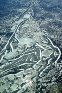
Eskers and frozen wetlands are typical knot nesting habitat on Southampton Island. In only a few weeks, the snow will be mostly gone and the wetlands will produce insect forage for knots.

Most knots choose to nest in relatively barren tundra slightly higher in elevation than more common Arctic nesting shorebirds. The latter prefer the lush wetland tundra along the coast and in the bigger river drainages because of the abundant prey early in the season. So why are knots drawn to colder and more barren places? We suspect they rely on the more persistent snow cover to discourage predation while they lie low in small patches of snow-free patches. Most predators prefer the lush areas with relatively dense shorebird nests. By the time the knot young hatch and are ready to feed, the protective snow barrier melts and the adults take their brood to the surrounding defrosted wetlands. By then shorebird prey are abundant.


So we suspect that at this point in the nesting season, we will find eggs just starting to hatch and soon the adults will lead their young to the nearby wetlands. Rick Lathrop, head of the Rutgers University Center for Remote Sensing and Spatial Analysis (CRSSA), has prepared mapping that will help us find prospective nest sites with the following characteristics:

  1. Areas with less than 5% vegetation (We will especially be looking for eskers, or sinuous frost-cracked rocky ridges that snake through the best knots habitats.)
  2. Numerous nearby patches of wetlands or small lakes with interconnecting streams
  3. Areas of slightly higher elevation that stay snowy longer into the season


Map prepared by Rick Lathrop of CRSSA lab at Rutgers, indicating prime areas to search for knots and their broods.

We have several targets but we are not certain that we can get to them. We hope to drive into the interior areas of Southampton on a new road built to help residents access new fishing sites. We want to take a truck as far as possible to carry our supplies and equipment. At the road end we will still have to move everything with ATVs to the areas of greatest probability, which are likely to be about 10-20 miles off the new road. It’s hard to plan.


But the rewards are great. If we are successful we will be able to study red knot for the first time without the need of being flown in to a remote place at great expense. We shall see.


For the original blog entry, see Larry’s post here.

Stay tuned for further updates!
Update from the Arctic: News from Our Shorebird Scientists

CWF’s Larry Niles and his colleagues left yesterday on a three-week trip to Northern Canada to search for the nests of Red Knots and other shorebirds in their Arctic breeding territory. We’ll be following him and posting summaries of his blog entries as he reports from the field.


A red knot with his brood of chicks.

The odd thing about the shorebirds of Delaware Bay is that they are not really of Delaware Bay but of the Canadian Arctic. The most important part of their lives is spent in the barren high tundra of the Arctic, in places like Southampton Island, located on the north end of Hudson Bay. We have worked in Southampton Island for 6 years studying the red knot but stopped because the decline seen in Delaware Bay was more than apparent in the Arctic – birds literally disappeared from our study site.


Map of red knot 1VL developed from a geolocator when recaptured on Delaware Bay. 1VL nested on Southampton Island.

It’s been 8 years since then, and now we are returning to begin new research on red knots. The first job of our small team (Larry Niles of the Conserve Wildlife Foundation of New Jersey, Mark Peck of the Royal Ontario Museum, Rick Lathrop of Rutgers University, Amanda Dey on vacation from NJ Division of Fish and Wildlife, and Steve Gates) will be to catch adult birds and attach geolocators, including a new type with a small radio transmitter to help relocate the bird next year. These small devices allow us to track birds around the globe. Our second job is to finish work started years ago on developing an Arctic-wide habitat map for red knots. These two projects are interrelated. Relocated knots help us determine the important places that define red knots habitat. We started this work in our first year.

From the data we collected in that first flight and subsequent flights, we were able to construct this map of red knot habitat in the Canadian Arctic.

In 2000, Mark Peck and I hatched a plan to search for knots with transmitters that we attached while the birds stopped over on Delaware Bay. We were foolish enough to think that we could follow the birds to the Arctic and relocate them from an airplane. We didn’t really grasp the odds of success. The transmitters had a range of 8 miles, and we would have to search an area the size of the eastern US. Our anxiety grew when we found that with the cost of renting a plane in the Arctic, we could afford only a few days of searching. As it turned out, we only needed one. Lucky for us, we flew Southampton Island and to our surprise found 8 birds with transmitters. We spent the rest of our time on the ground searching and eventually found the first nest of rufa knots.


The Arctic shorebird research team waiting for their flight in Winnipeg. From left to right: Rick Lathrop, Larry Niles, Amanda Dey, Mark Peck, and Steve Gates.

Over the years our experience has grown but the knot population has shrunk, making them more difficult to find. Knots are tough to find anyway. They occur in very low densities (usually less than one per square kilometer) and the non-incubating adult doesn’t defend the territory, which is the usual clue that a shorebird is nesting nearby. Knots rarely nest where other shorebirds nest, choosing instead to lay eggs in barren tundra far from the coast. We hope to improve our chances this year by going later than normal and searching for adults with broods instead of nests.


For the full blog entry, see Larry’s post here.

Stay tuned for further updates!


Shorebirds, Horseshoe Crabs and Stewards…

together on the Delaware Bay

by Larissa Smith, Wildlife Biologist/Volunteer Coordinator

Shorebird Steward Liz Hermosa shows beach visitors a clump of horseshoe crab eggs on Cook's beach.
Shorebird Steward Liz Hermoso shows beach visitors a clump of horseshoe crab eggs on Cook’s beach.

Once again migratory shorebirds, including the NJ endangered red knot, have returned to the Delaware Bay to feed on horseshoe crab eggs.  This annual phenomenon brings people from around the world to the Delaware Bay beaches.

Beaches are closed during the migration from May 7th through June 7th to protect the shorebirds from disturbance when feeding.  Just as the birds return each year so do volunteer Shorebird Stewards who educate the public about the beach closures , shorebirds and horseshoe crabs on nine beaches in Cape May and Cumberland County.  Now is a great to come out to the beaches to view shorebirds and crabs and say “hi” to the stewards.

This year the hot spots for shorebirds  in Cape May County  are Reed’s , Cook’s  and Kimble’s Beaches and  Fortescue in Cumberland County.


Oystercatcher Project in Flight

Surveying American Oystercatchers from the Sky

By Stephanie Egger, Wildlife Biologist

Stephanie Egger of CWFNJ, before take off.
Stephanie Egger of CWFNJ before take off.

If you happened to be taking a stroll on a chilly February afternoon on the beaches of New Jersey and you saw a blue and white Cessna in the sky flying in a not-so-straight pattern, well that was me in the back of the teeny 4-seater plane.  Last Tuesday I helped complete the New Jersey segment of the American oystercatcher winter survey, which is being directed by Shiloh Schulte from the Manomet Center for Conservation Sciences, in partnership with the American Oystercatcher Working Group. Other staff from the Conserve Wildlife Foundation of New Jersey and the State’s Endangered and Nongame Species Program were on the beach (or in a boat) “ground-truthing” the survey in order to verify the data that were collected during the flight.

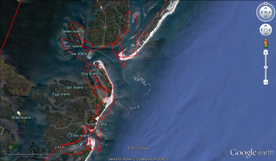
Flight Path
Flight path during one portion of the New Jersey survey for American oystercatchers.

After swallowing a motion sickness pill as a precautionary measure (thanks Shiloh!) our four hour flight took off early afternoon from the Cape May County Airport, starting with a survey of Cape May Inlet.  We continued our flight north, surveying Hereford, Townsend’s, Corson’s, Great Egg Harbor, Absecon, Brigantine, Little Egg, Barnegat, and Manasquan Inlets and finally Sandy Hook Gateway National Recreation Area.  We saw flocks of wintering oystercatchers, from a handful to up to 140 birds, using sand and marsh habitats.  It was quite the first-time experience for me. Surveying from the air is NOT the easiest, but especially if a flock is seen at the last second and the plane has to bank hard. I admit I even glanced around for a sick bag a few times, but stayed strong! I don’t get seasick or airsick, but flying in a Cessna and doing numerous turns and banking was a whole new feeling.  There were many times all I could see from the backseat was water with no horizon to focus on, all while attempting to take good photographs of the flocks for the count. Try doing that when you are sideways!  In the end I managed to do really well at both, taking photos of the flocks and not getting sick during my aerial survey. Go me! Continue reading “Oystercatcher Project in Flight”

Photos From the Field

Oystercatcher Technician shows diversity of tasks in wildlife conservation

By Alfred Breed, CWF Technician

My official job title with Conserve Wildlife Foundation of New Jersey is  “American Oystercatcher Technician”.  As such I am tasked during nesting season with monitoring Oystercatcher nesting sites, and during migratory season with locating flocks of Oystercatchers, counting them, resighting marked birds in each flock, recording data of field survey results and reporting our NJ counts and resights to a central database that holds data from the other reporting states in the migratory flyway.

As is usually the case in any job that has a “description”, the phrase “and other such tasks as assigned” is included as a catch-all for things that aren’t specifically listed in the description, but can be an important part of the duties of the position nonetheless. In my case these ancillary tasks are different each day, and often involve three of my favorite things: wildlife (of course!), science, and gear.  Working around my Oystercatcher surveys, which can only be conducted at high tide, I might be tasked to go to a location anywhere in the state and survey for a particular species of plant or animal; or to site select, construct, install, use, maintain, and troubleshoot various types of data collection or other equipment throughout South Jersey.

Trucks, trailers, boats and kayaks are the big-ticket items that I use every day, but I’m lucky enough to use a large variety of other cool tools and equipment as well. Driving is often a big part of my day, with travel times between sites eating up significant portions of the workday.  Sometimes I’m a wildlife EMT or ambulance driver, saving sick or injured animals from their immediate predicament and/or transporting them to various certified rehabilitation facilities located throughout the state.

Best of all is when I’m asked to assist visiting scientists or other conservation partners in their work, which can mean bio-sampling or banding.  Direct human/wildlife interaction is only appropriate when it is  for valid scientific or conservation management purposes, and is sanctioned and a permit issued by the appropriate governing body.  To be a staff member and so to be included in these sanctioned and permitted activities is a rare privilege indeed.

Each day is different, always interesting, occasionally exciting, and always personally rewarding as I play a small part in the management of threatened and endangered wildlife and the habitat that we share.

HURRICANE SANDY STORM REPORT

Assessing the damage to coastal wildlife and their habitat

By Stephanie Egger, Wildlife Biologist

CWFNJ Wildlife Biologist, Stephanie Egger, surveying American Oystercatchers post Hurricane Sandy.

As we all know Hurricane Sandy caused severe damage and devastation to New Jersey residents, homes, and their businesses, but we must not forget that wildlife can also suffer from the impacts of a hurricane.  CWFNJ’s Beach Nesting Bird Project Manager, Todd Pover, Alfred Breed, CWFNJ Field Technician, and myself, conducted wildlife/habitat assessments on beaches from Brigantine to Cape May after the storm.  Our nesting sites further north in Ocean and Monmouth Counties were still not accessible at that time to evaluate.  We assessed nesting habitat for beach nesting bird species, especially Piping Plover as well beach/inlet habitat used by migratory shorebirds, particularly American Oystercatchers.

A view of the severe erosion at Strathmere Natural Area, Cape May County, NJ.

As expected, many of our nesting sites and sites that are also used by migratory shorebirds for roosting were hit hard by Hurricane Sandy, losing a great deal of sand and suitable habitat.  However, in some locations such as Stone Harbor Point and North Brigantine Natural Area, the storm scoured out areas with too much vegetation which is good for beach nesters as they prefer sparsely vegetated areas. Sand was also pushed back into the dunes to create blowouts and overwash areas that may serve as additional habitat.  Many of the areas seem to be very low lying now from the loss of sand and might be more flood prone which could impact the beach nesters in the spring.

We also observed migratory songbirds, golden-crowned kinglets, which were taking shelter and flittering through the back dune/bayberry habitat right after the storm.  This was a good reminder of the value of New Jersey coastal habitat for songbirds as they migrate down the coast.

American Oystercatchers roosting with juvenile Black Skimmers at Strathmere Natural Area, Cape May County, NJ

As part of our assessment, we conducted American Oystercatcher surveys as a significant number use New Jersey beaches for roosting during the fall and winter.  Luckily, approximately 900-1,000 American Oystercatchers were still using our southern coastal inlets after Sandy, about the same number of birds observed the week before the storm.  Thanks to funding from the National Fish and Wildlife Foundation we were already conducting fall surveys for American Oystercatchers and in the position to compare their numbers before and after the storm.

Only time will tell if the habitat will build back up enough in time for the spring as the birds begin to arrive for the nesting season or if it will have lasting impacts on migratory bird species. We hope to conduct further assessments to gain a better understanding of the short- and long-term impacts to wildlife from Hurricane Sandy and how that may affect conservation and recovery effort for these species moving forward.


For CWFNJ’s videos of wildlife and habitat assessments click on the links below:

Wildlife Assessment Post Hurricane Sandy at North Brigantine Natural Area, NJ

Wildlife Assessment Post Hurricane Sandy at Stone Harbor Point, NJ

Wildlife Assessment Post Hurricane Sandy at Strathmere Natural Area, NJ

Piping Plover Dreams

How to Make a Plover Biologist’s Day!

By Todd Pover, Beach Nesting Bird Project Manager

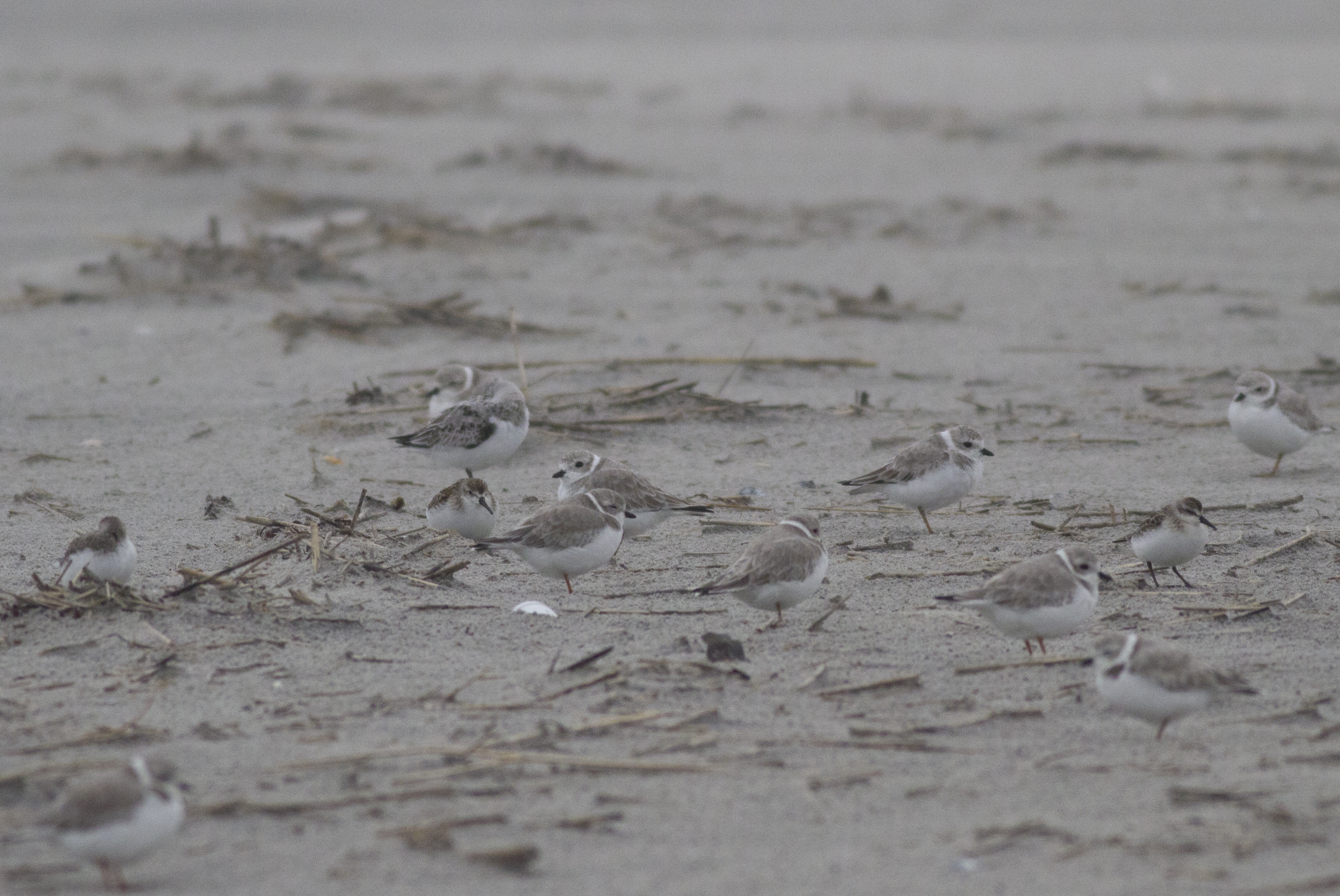
Group of Post-breedingl Piping Plovers Roosting at
Stone Harbor Point
Photo courtesy of Sam Galick

We spend a lot of time on the beach nesting bird project discussing the love/hate relationship the public has with piping plovers. For every person that supports our conservation efforts for this highly vulnerable shorebird, there seems to be at least two people that complain the plovers take up too much of the beach or prevent dogs from being allowed on the beach.

But every once in awhile, you have one of those perfect encounters that makes all the work worthwhile, so I thought I’d share a recent one with you.

Last week I was conducting a piping plover migration and band resighting survey at Stone Harbor Point. The fact that it was an extremely warm and sunny October day – extending the illusion of summer for just a wee bit longer – alone should have been enough to make me content. Then there was the very cooperative flock of 13 piping plovers, including three with color bands that I recognized as our summer breeders. All and all, it was shaping up as a good day in the field!

As I was almost wrapping up my survey I noticed a birdwatching couple a little further down the beach gazing off into the distance through a scope. On the off-chance they had noticed some plovers I had missed I approached them to see what they were looking at.

“Seeing anything interesting?” I inquired.

“A flock of royal and caspian terns, but no, nothing much really,” the man replied. And then out of the blue he added, “No piping plovers.”

This was a surprising comment since I hadn’t prompted him and October isn’t exactly prime time for piping plover viewing in New Jersey (or anywhere on the breeding grounds for that matter). I proceeded to strike up a conversation with the couple. It turned out they were from Holland, this was their first trip to the U.S., and they were on a birding/nature trip that was starting in the Cape May area.

We talked a little about the work I did and then, naturally, I mentioned to them that there actually was a group of piping plovers just 50 yards away from them on the beach. Given their pale sand color, even more so in non-breeding plumage, I wasn’t surprised the couple had walked right past the plovers.

The man’s eyes widened and he said, “Really?”

Of course, I led them back to the plovers. As we approached the plovers and they came into clear view, the man stopped and turned to me and said, “I have been dreaming of seeing a piping plover for years.”

It isn’t too often you get to make someone’s dream come true. And it is nice to know someone else is dreaming of plovers other than me.

Have You Seen This Bird?

LOOKING FOR HELP FROM BIRDWATCHERS TO FILL-IN DATA GAPS

By Michael Davenport, Marine Species & GIS Programs Manager

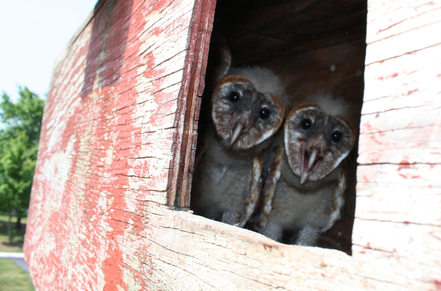
Young barn owls. Photo by MacKenzie Hall.

Conserve Wildlife Foundation staff work with the New Jersey Endangered and Nongame Species Program (ENSP) to manage and populate the state’s official database of rare wildlife, known as Biotics.  Currently, this database contains over 35,000 animal and plant records within New Jersey.  ENSP and CWF currently collect and enter data for the state’s 173 endangered, threatened, and special concern species.

There are several species of birds for which more observation data would be useful; and it’s likely that birdwatchers or other nature watchers may have the data needed.  Most good birdwatchers keep logs of what they’ve observed, when, and where.  It would be helpful if anyone with detailed observation data for the species listed at the end of this blog could submit their data for potential inclusion in the Biotics database.

To submit your observation data, please complete a Rare Wildlife Sighting Report Form.  The form is available on ENSP’s website for download as well as instructions for completing the form (a map must be attached when submitted).  In addition to the species listed below, please feel free to submit one or more forms for any of the state’s endangered, threatened, or special concern species.  A complete list of all of the species tracked by the state can be downloaded here.

If you have a large amount of data to submit, please contact Mike Davenport of Conserve Wildlife Foundation at (609) 292-3795 – alternative data submission options may be available (such as submitting Excel spreadsheets or GIS files).

Barn Owl (Tyto alba)
Nashville Warbler (Oreothlypis ruficapilla)
Saltmarsh Sparrow (Ammodramus caudacutus)
Sharp-shinned Hawk (Accipiter striatus)
Spotted Sandpiper (Actitis macularius)
Whimbrel (Numenius phaeopus)
Winter Wren (Troglodytes hiemalis)