Conserve Wildlife Foundation introduces new educational contest for 5-8th grade students in New Jersey
by Lindsay McNamara, Communications Manager
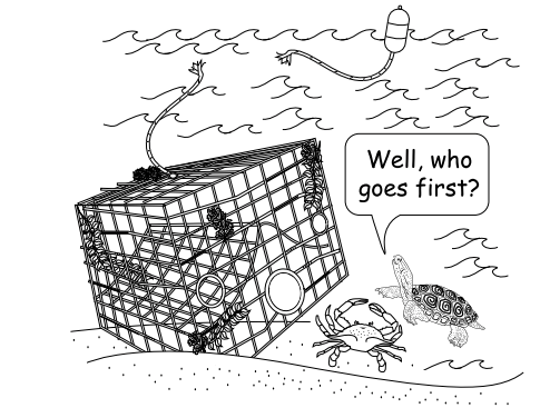
Image by: Jessie Peter (2009) “The Educator’s Guide to Marine Debris”
The scientists at Conserve Wildlife Foundation, NOAA, students from the Marine Academy of Technology and Environmental Science (MATES), and other partners are working with local fishermen to locate and recycle over 1,000 abandoned crab pots that litter the Barnegat Bay watershed.
Abandoned crab pots are a form of marine debris, or litter that ends up in oceans, seas, or other large bodies of water. Every year, tons of marine debris is left behind in Barnegat Bay and surrounding waters. When a fisherman’s gear is lost or abandoned it can trap, hurt or even kill marine wildlife like fish, crabs and the diamondback terrapin, a small turtle that lives in the salt marsh.
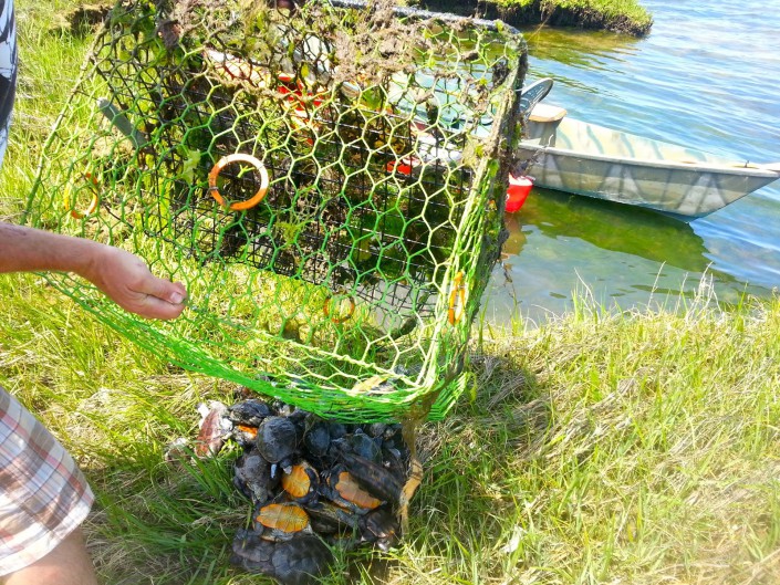
Nearly 50 diamondback terrapins drowned in one abandoned crab pot. Photo by Shannon Alexander of Bay Country Kayaking
To help fix the problem, our team of scientists will locate (with sonar technology) and take the crab pots that have been lost or left behind in the water. The old and rusty crab pots that are recovered will be recycled and converted into energy!
Calling all students! Do you want to help too? Enter our Species on the Edge: Marine Debris Edition contest and draw a design that shows how our project will help Barnegat Bay and marine wildlife like the diamondback terrapin.
Open to all New Jersey fifth-eighth graders in public, private, or home schools.
The contest opens on Friday, March 4 and closes on Friday, May 20, 2016.
Decal designs will be judged by marine scientists. Judging takes place in June.
The winner will be notified by the end of June.
The winning design will be printed on 2,500 stickers to use as the official “logo” of the project. The winning student will receive two free passes to Jenkinson’s Aquarium and spend a day in the field with one of CWF’s wildlife biologists.
Our abandoned crab pot project brings together the NOAA Marine Debris program, Fishing for Energy partnership, CWF, MATES, Monmouth University, Stockton University, ReClam the Bay, and local fishermen and baymen. Funders of this project include: NOAA Marine Debris Program, National Fish and Wildlife Foundation, Covanta, and the New Jersey Corporate Wetlands Restoration Partnership.
CWF leading the charge to provide free recycling and disposal of derelict fishing gear throughout the Barnegat Bay watershed
by Lindsay McNamara, Communications Manager
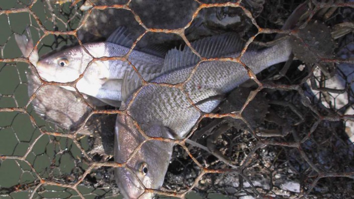
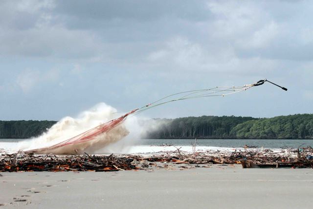
Abandoned crab pots unnecessarily trap fish and harm other marine life. Photo credit: NOAA
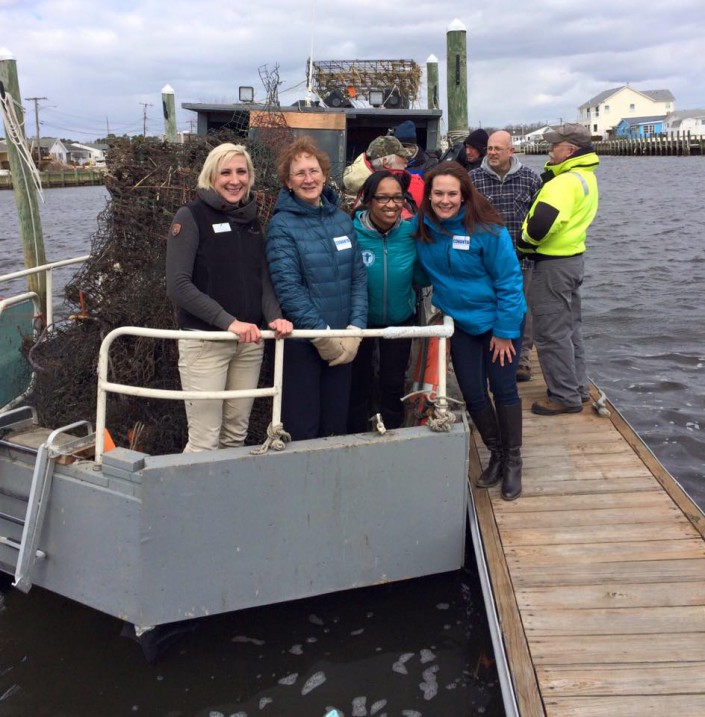
Conserve Wildlife Foundation is proud to collaborate with the Fishing for Energy partnership — an innovative public-private effort that provides commercial fishermen a no-cost solution to recycle old and unusable fishing gear — to recycle an estimated 26,000 pounds of derelict crab pots and other marine debris collected throughout the Barnegat Bay watershed as part of a removal project over the next two years. On Friday, we celebrated our new project with our Fishing for Energy partners at a press event in Waretown, New Jersey.
Abandoned or lost fishing equipment can threaten marine wildlife, like diamondback terrapins, in a number of ways, including by damaging ecosystems as nets and heavy equipment settle upon the ocean floor and through “ghost fishing,” wherein gear continues to catch fish and other wildlife even if abandoned or lost. Gear also can impact navigational safety, damage fishing equipment and boats that are in use, and have economic repercussions on fishing and shipping enterprises and coastal communities.
In just six days, RJ Cericola and other local fishermen have collected over 160 abandoned crab pots!
Look at all the abandoned crab pots removed so far!
“By recycling thousands of dangerous abandoned crab pots, our team is protecting vulnerable wildlife such as the diamondback terrapin, which inhabit the same shallow coastal waters in Barnegat Bay where pots are often lost or abandoned,” said Stephanie Egger, CWF wildlife biologist and principal investigator. “Terrapin population declines, reduced growth, and changes in sex ratios have been directly attributed to by-catch mortality in crab pots. We are so thrilled to work with local fishermen and all of our project partners, particularly the Fishing for Energy program, NOAA, and the New Jersey Corporate Wetlands Restoration Partnership.”
This two-year marine debris removal project, led by CWF and supported by a NOAA Marine Debris Program Community-based Marine Debris Removal grant, is working with local crabbers to locate and remove more than 1,000 derelict crab pots from Barnegat Bay. As part of this project, CWF is partnering with the Marine Academy of Technology and Environmental Science, Monmouth University, Stockton University, ReClam the Bay, New Jersey Corporate Wetlands Restoration Partnership (NJCWRP), and the recreational and commercial fishing community to identify, retrieve, and inventory derelict crab pots. The project is also conducting education and outreach activities on the impacts of derelict crab pots including the development of a lesson plan for schools, presentations for the community, developing informational print materials, and collaborating with the WeCrab education and outreach project led by the Jacques Cousteau National Estuarine Research Reserve/Rutgers University and Stockton University.
MATES students collecting data on the derelict crab pots.
“NJCWRP is proud to support this coalition of partners working on innovative projects to benefit the ecological quality of Barnegat Bay,” said Russell Furnari, chair, NJCWRP. “Removing thousands of these derelict crab pots not only enhances habitat, but also reduces navigational hazards, human health issues, and fishery impacts. We are thrilled to help provide outreach and educational campaigns to the local community, which will prevent additional lost pots and promote a deeper understanding of the bay’s habitat and wildlife.”
The Fishing for Energy partnership provided funds for the transportation and disposal of the gear found in Barnegat Bay through Covanta’s Energy-from-Waste facility in Union County, New Jersey. At the Covanta site, any metal found on the debris will be recycled and the remainder of the traps converted into clean, renewable energy that will power area homes and businesses. The recycled materials will be processed and converted into enough energy to power 2,200 homes for a month!
From left to right: CWF’s Stephanie Egger, Covanta’s Meg Morris, NFWF’s Courtney McGeachy, and Covanta’s Kristin Blake.
Fishing for Energy is a nationwide partnership between the National Fish and Wildlife Foundation; the NOAA Marine Debris Program; Covanta, a New Jersey-headquartered sustainable waste and energy solutions company; and Schnitzer Steel Industries, one of the largest metal recycling companies in the United States. The partnership offers conveniently located collection bins for disposal of old fishing gear, making it easy for fishing communities – even small coastal communities like Waretown and Mantoloking – to deal with the issue of derelict gear. As a result, the partnership reduces the amount of gear that ends up in U.S. coastal waters and recycles and converts the remaining gear and debris into clean, renewable energy at Covanta’s Energy-from-Waste facilities.
Making Headlines: News Coverage from the Press Event:
New E-book Provides Everything You Need To Know About The Eagles And Their Celebrated Nest
by Lindsay McNamara, Communications Manager
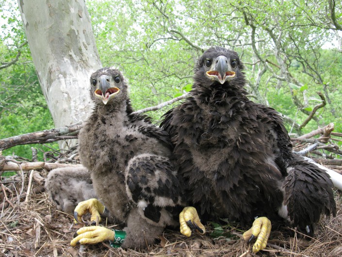
We are excited to announce that the new e-book, “Duke Farms’ Bald Eagles,” is now viewable online from any computer or tablet! A collaboration between Conserve Wildlife Foundation and Duke Farms, the free, photo-rich e-book provides everything you need to know about the eagles, their beloved nest, and the new high-definition EagleCam that enables viewers around the world to watch the eagle family at any time of day or night.
The e-book was written by Jim Wright, author of the popular posts about the eagles for Duke Farms’ “Behind the Stone Walls” blog, as well as, “The Bird Watcher” column for The Record. CWF Executive Director David Wheeler wrote the e-book foreward. Experts interviewed for the project include CWF’s eagle biologist Larissa Smith and Kathy Clark of New Jersey Division of Fish and Wildlife’s Endangered and Nongame Species Program.
Other chapters feature EagleCam lesson plan winner Diane Cook and the use of EagleCam in the classroom (complete with a link to lesson plans). The e-book also showcases the bald eagle’s All-American comeback in New Jersey and the other at-risk species that nest on Duke Farms’ 2,750-acre property.
The e-book — designed by Mimi Sabatino — also features cutting-edge page-turning software (try it with the sound on), links to the EagleCam itself, six videos and more than 30 pertinent webpages. Nature photographer Kevin Watson took all the incredible photographs of the at-risk species that have found a home at Duke Farms.
Updated Story Map Showcases Bald Eagle Nest Locations from 1985-2015
by Brian Henderson, GIS Specialist
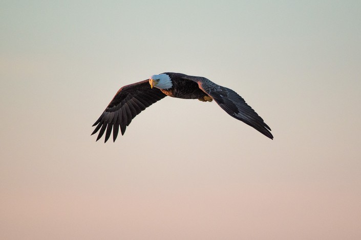
Photo by Northside Jim
Our story map The Return of Bald Eagles in New Jersey has been updated based on the 2015 Bald Eagle Project Report. The story map shows the locations of every eagle nest known to be active (meaning they laid eggs) in New Jersey since 1985 — the year when there was only a single nest in the entire state. The map presents an animated depiction of where eagles have nested each year, so you can track the bald eagle’s triumphant return to the Garden State! Viewing the animation shows you how eagle nests spread from a single point in Cumberland County across all of New Jersey through the years.
The story mapalso highlights a number of Feature Nests which include more detailed information about the projects underway at specific nests, such as the Duke Farm nest which has been featured on our EagleCam since 2008.
The number of nesting pairs of bald eagles has steadily increased each year. This trend continued in 2015 with a record 150 active pairs, which was a slight increase over 146 such pairs recorded in 2014. In 2015, there were 122 nests that successfully fledged at least one young compared to 115 successful nests in 2014 and the 199 total young fledged in 2015 was only slightly less than the record 201 young fledged in 2014.
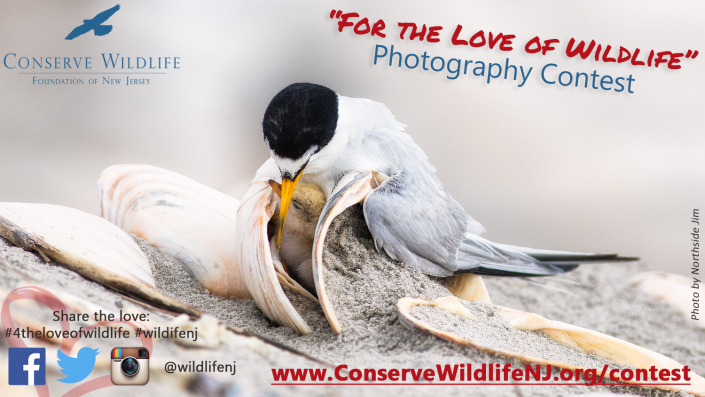
Conserve Wildlife Foundation’s “For the Love of Wildlife” Photo Contest will run from February 12, 2016 to March 25, 2016
by Lindsay McNamara, Communications Manager
New Jersey might be the most densely populated state, but it is also home to a diverse array of wildlife. From bobcats in the north to Eastern tiger salamanders in the south, many different species of wildlife live in the variety of habitats found in New Jersey. Our photography contest is meant to showcase the love for and need to protect the endangered and threatened wildlife that call New Jersey home.
The “For the Love of Wildlife” Photo Contest is free to enter! Two grand prize winners — one youth and one adult winner — will receive $250. The People’s Choice Winner will win a canoe trip for two on the Batsto River in Wharton State Forest courtesy of Pinelands Adventures.
Submit your photos by 8 PM on Friday, March 25, 2016 in the following categories:
New Jersey’s Rarest Residents: Endangered and Threatened Wildlife Species Only
Update from Brazil: “We are Going to Have to Science the ‘Heck’ Out of This”
by Dr. Larry Niles, LJ Niles Associates LLC
We came to Brazil to conduct a rigorous scientific study of the wintering population of shorebirds in a place where the land and sea act against any rigorous protocol. It would be easier to just go out and count birds and identify their habitats and prey, but our charge is more difficult.
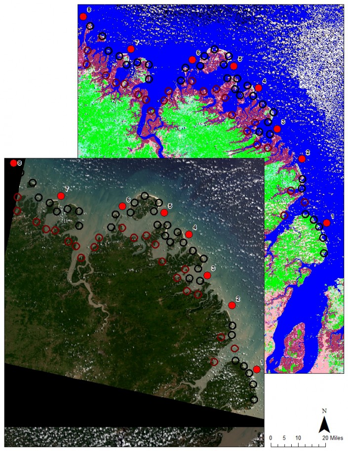
The survey wraps around satellite imagery, strange unintelligible wavelength data coming from satellites hovering over the earth that can be transformed into brilliant and useful maps in the right hands. Those hands belong to Professor Rick Lathrop and his post doc Dan Merchant. Rick leads the Center for Remote Sensing at Rutgers and he and I have collaborated on projects ranging from municipal habitat conservation planning to Arctic red knot habitat mapping. He has created one of the most alarming maps that every person from New Jersey should know about.
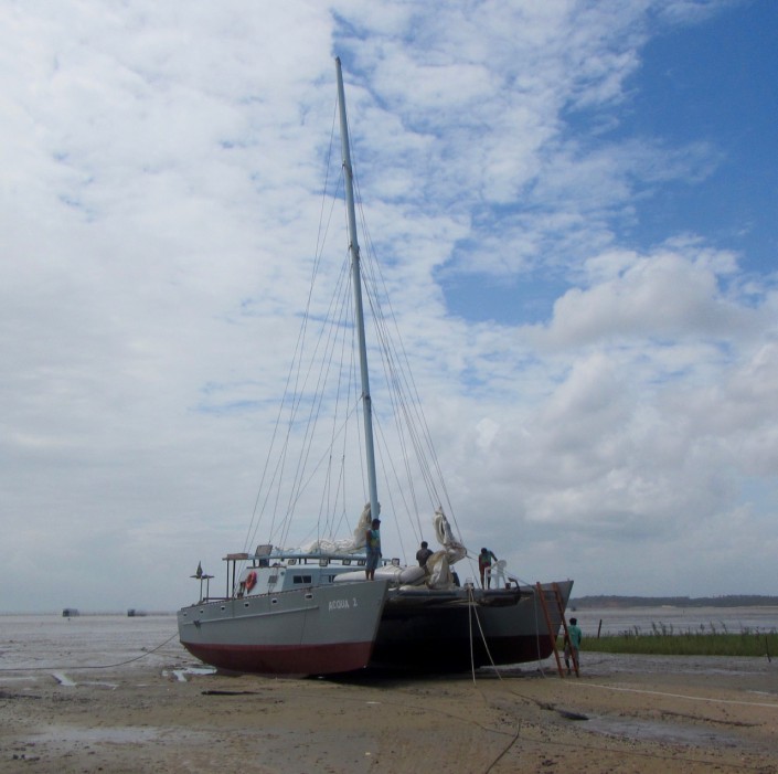
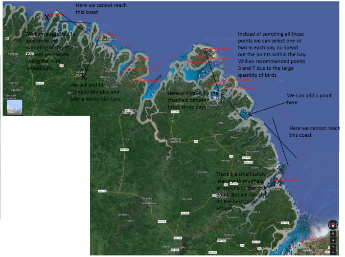
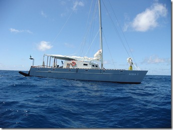
The mapping of Reentrancias Maranhenses, an internationally recognized site of ecological importance is especially tricky. Our research platform is a 50-foot boat and we will be out of cell and internet contact for much of the time. Our method of collecting data for the mapping was devised by the whole team, but especially with the help Professor David Santos of the University of Maranhao, my colleague Dr. Joe Smith and Humphrey Sitters of the International Wader Study Group.
Our 50-foot catamaran
It focuses on collecting bird and habitat information using randomly selected survey points. In other words, we will try to pick places at random to survey so that when we combine them we will have a sample that represents the entire area, not just the places we surveyed. It’s like trying to figure how many different kinds of chocolates are in a valentine. If you take them all from one side then you might have sampled the chocolate covered cherry section leading to believe they are all one kind. But if you choose chocolates at random than you will find the box includes other kinds, caramel or fruit or nutty chocolates. This is making me hungry, but you get the point.
The area of our box we is very large, bigger than New Jersey, and it grows and shrinks every day with the tides. So, sampling is tricky business because a sample at low tide, when the tide is out exposing vast areas of intertidal mud and sand flat, is very different than when the tide is high. So we will be classifying habitat, or stratifying it, so we can focus on limited survey time to get the best sample.
Once collected we can start making maps. All data will be geo referenced – or located precisely with GPS units – so it can be accurately mapped. With this, we will train the satellite maps to outline the habitat best for shorebirds.
All this while exploring areas that have received little scientific scrutiny and under tropical conditions, almost daily rain, a persistent 20 mph wind and summer heat. Add parasites, mosquitoes and diseases like malaria and one can see this a rugged undertaking.
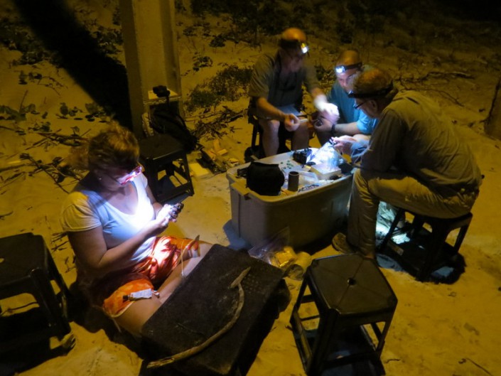
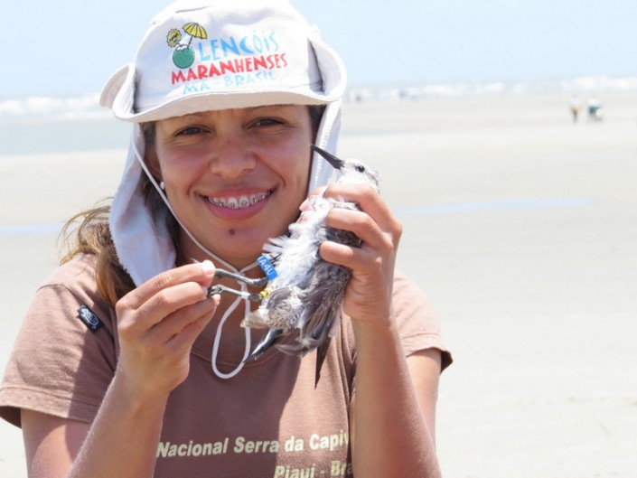
Our crew is up to it. Besides those mentioned above Mark Peck from Royal Ontario Museum, Danielle Paluto from the Brazilian CEMAVE (a counterpart to our USFWS), Steve Gates a veteran of expedition on other SA trips, shorebird expert Dr. Mandy Dey, Stephanie Feigin from Conserve Wildlife Foundation of New Jersey and the author round out a dream team of bird study in difficult places.
On our Expedition to Study Shorebirds along the Northern Coast of Brazil
By: Dr. Larry Niles, LJ Niles Associates LLC
Ana Paula with Red Knot
The largest mangrove forest in the world covers the Brazilian coastline at the equator near the mouth of the Amazon river. The forest extends out into the Atlantic in long peninsulas tipped by wind swept and mostly inaccessible beaches. The forest, beaches and their long intertidal mud and sandy low tide flats support the largest wintering population of shorebirds in the hemisphere, perhaps the world. The red knot, a listed species in both North and South America, also uses this remote tropical coast.
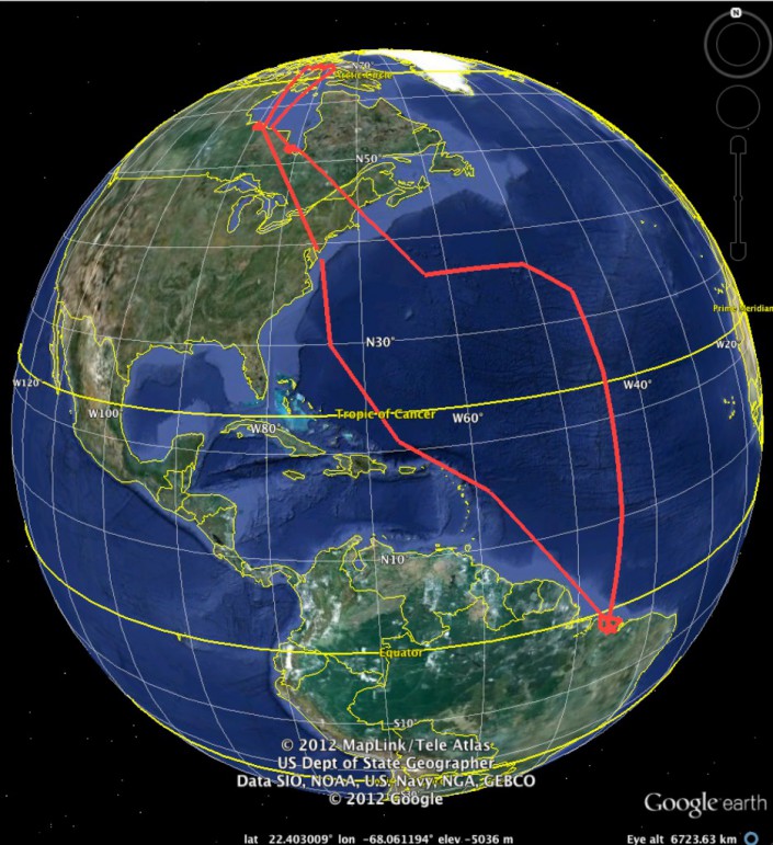
Boat Trip RouteCatamaran
With scientists from the U.S., Canada, England and Brazil, we will attempt a large scale mapping of this important habitat using state-of-the-art satellite mapping. We will do this from a 50-foot catamaran and two zodiacs hopping from one mangrove estuary to another and conducting bird surveys targeting key areas over a 150 mile-section of the coast. We will be the first to survey some areas. Our goal is to figure out the main threats to both bird and habitat.
To understand the importance of this area one has to think about it like a shorebird. Although born in the Arctic they actually spend only a few months there. They spend a few months moving from their nesting area to their wintering area. They spend the rest of their lives, the majority of their year in the wintering area. A threat to the wintering area would be grave.
Most of our survey zone is part of the Reentrancias Maranhenses, a protected area of the state of Maranhao, Brazil. Our catamaran captained by William Thomas will leave from a small town near the city of Sao Luis, Brazil. From there we will sail along the coastline moving in and out of the mangrove islands to survey shorebirds, habitat and marine invertebrates. We will “geo reference” all data, or take detailed coordinates so the data can be reproduced on satellite mapping.
Satellite Map
Satellite maps aren’t really maps as most people understand — pictures or drawings of a section of the earth — they are digital files of remotely sensed data, they are only wavelengths of light that must be interpreted to represent actual habitat. We will train the satellite data so that each habitat will be represented by a combination of spectral data — colors in sense.
Environmental disturbance. Photo by Mark Peck.
Once completed, we can relate the habitat maps with information on birds, their prey and equally important, the threats to the birds and prey. For example, shrimp farming is growing in this area. Entrepreneurs are stripping the intertidal zone of mangrove forest, diking the area and then growing shrimp. Once the area accumulates too much waste and chemicals, they abandon the site and move on to damage another mangrove forest. We will determine which areas are of importance to the birds and potential targets for shrimp farmers. But there is more: oil spills, disturbance from tourists, water pollution are among many.
Over the next three weeks, we will be reporting on our work on this blog.
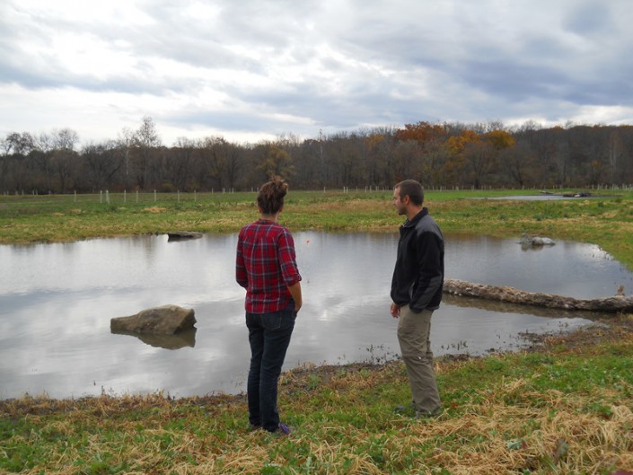
Even during these cold winter months Conserve Wildlife Foundation biologists are out in the field! The winter is often the best time of year to fully see the land and make accurate assessments on potential management. My role as a Private Lands Biologist along with our partner the U.S. Department of Agriculture, Natural Resources Conservation Service (USDA-NRCS), is to work with private landowners and help them manage their property for the benefit of wildlife and to conserve other natural resources.
Often times this means walking the property with landowners who are interested in enhancing or providing habitat for wildlife. On our walk, we look for invasive species, erosion concerns, existing hydrology, native vegetation and the potential to enhance the property for wildlife. We make recommendations on how to best manage the land for wildlife, but ultimately it is up to the owner.
Potential enhanced waterfowl and amphibian habitat.
This winter, I have met with several landowners whose goal is to provide waterfowl and amphibian habitat on their land. We have also visited forested lands to determine their suitability to create Golden-winged Warbler habitat, an endangered songbird.
Not every day is a close encounter with wildlife! But helping private landowners learn about sustainable land management and implement conservation goals on their property may help provide food, water and breeding grounds for many of New Jersey’s native wildlife species.
CWF and partners have created or restored over 225 acres of Golden-winged warbler habitat in New Jersey since 2012
by Kelly Triece, Private Lands Biologist
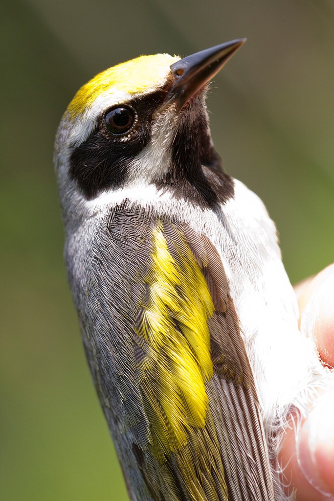
Golden Winged Warbler. Photo by D. Kenny.
Take a look at this Golden-winged warbler — a Neotropical Migrant songbird that breeds in New Jersey. This songbird is a species of special conservation concern in the United States and endangered in New Jersey, experiencing population declines due to loss of young forest habitat.
Did you know? In the past 30 years, over 11,000 acres of upland shrub and emergent wetland habitat have been lost to succession in New Jersey. This habitat is important for Golden-winged warblers because it is their primary breeding habitat. Fortunately, their secondary habitat, upland forests, have remained stable in the state.
Therefore, it has been the goal of many wildlife management agencies to continue to create young forest habitat, while protecting upland forests as well.
Conserve Wildlife Foundation and our partners (Natural Resources Conservation Service, New Jersey Division of Fish and Wildlife and New Jersey Audubon Society), have worked with private landowners to create or restore over 225 acres of Golden-winged warbler habitat since 2012 in New Jersey.
Our managed forests have a statistically significant higher diversity of birds than unmanaged sites!
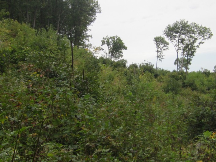
Young forest habitat managed for Golden-winged warbler. Photo by Kelly Triece.
Young forest habitat, also known as scrub-shrub habitat, is new or regenerating forest that is less than 20 years old. Young forest habitat is important for many birds, especially the Golden-winged warbler. The open canopy of a young forest also helps provide food such as berries and insects to newly fledged birds, wild turkey, ruffed grouse, reptiles, black bears, bobcats, and butterflies.
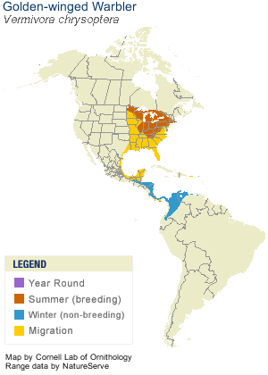
Golden-winged warbler home range
The breeding range of the Golden-winged warbler extends along the Appalachians from the northern portion of Georgia in the south to Vermont in the north. The winter range for this species is southern Mexico and Central and South America.
Follow us in February 2016 when biologist Kelly Triece travels to Honduras to see the Golden-winged Warbler in its winter habitat!
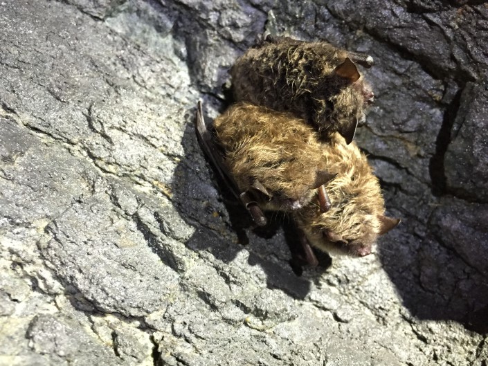
“Luci,” a little brown bat banded in July 2014 at 2008 Women & Wildlife Award Winner Barbara Brummer’s pond house (a New Jersey maternity site) was recently resighted!
Biologists doing a hibernaculum survey in New York State found Luci in a mine in one of New York’s largest little brown bat hibernaucula about 70 miles north from her summer roost site in New Jersey!
“She is spending the winter with 37,000 of her closest friends.” – Carl Herzog Wildlife Biologist, New York State Department of Environmental Conservation, Wildlife Diversity Unit